Blois – Panoramic View of the Loire Around 1924
Geographic description
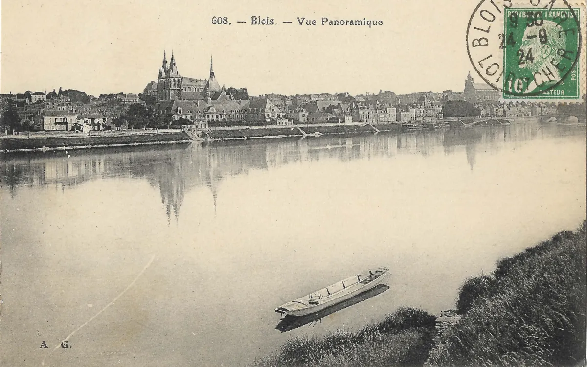
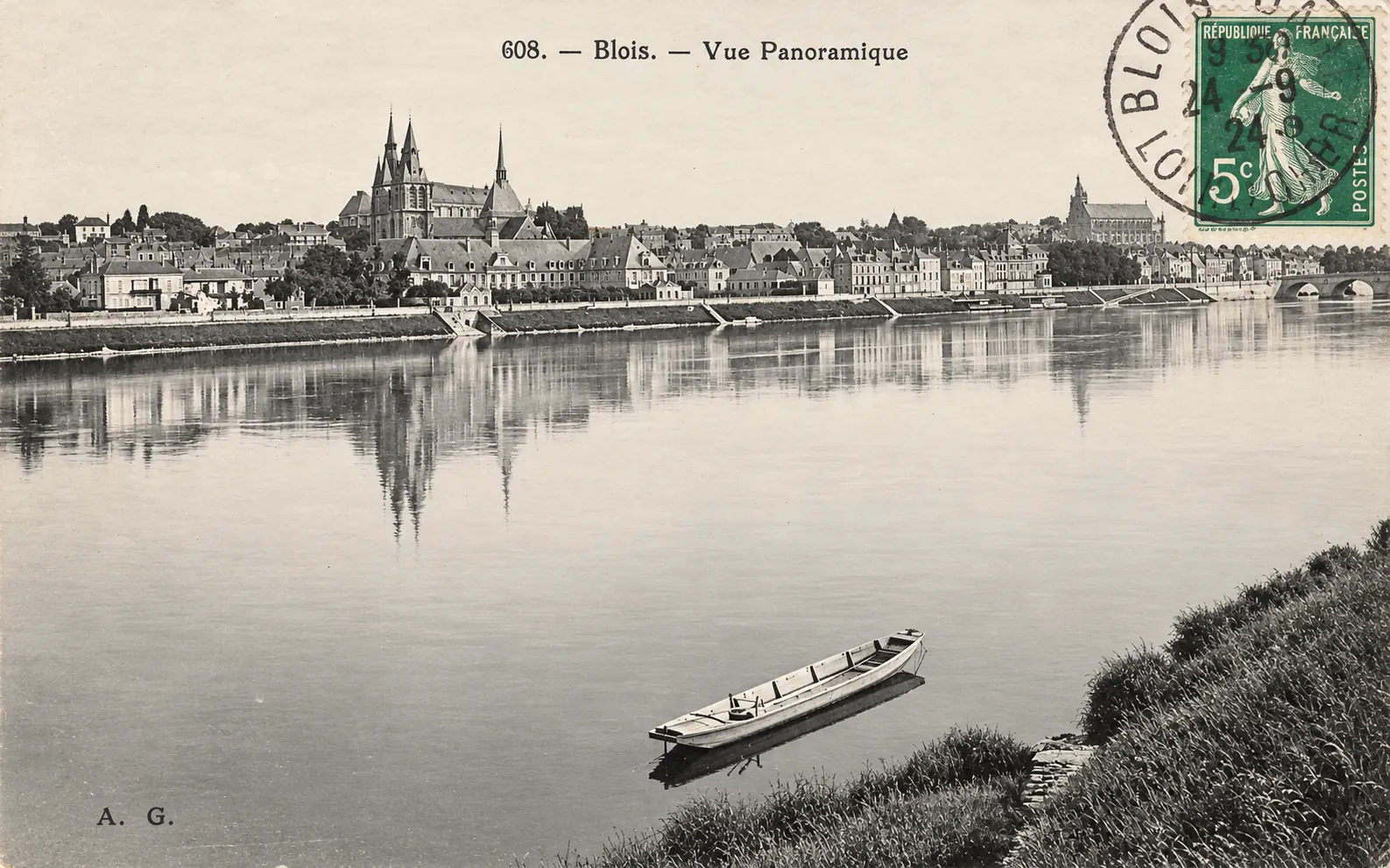
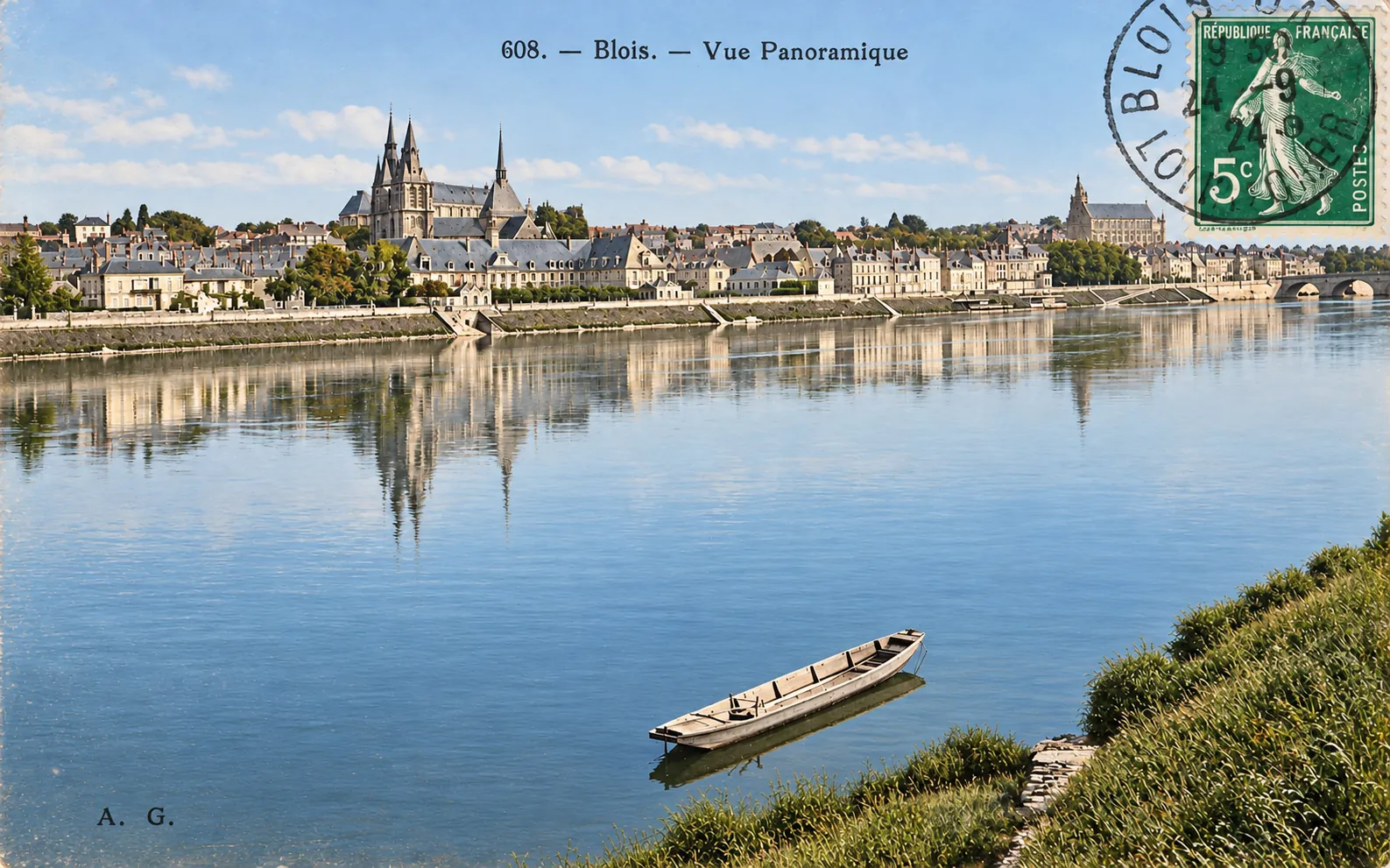
This panoramic view of Blois captures an impressive riverside landscape in the historic town of Blois, located in the Loir-et-Cher department of the Centre-Val de Loire region in central France. Photographed from the southern bank of the Loire, probably near the Vienne district, the scene provides a sweeping perspective of the town’s waterfront, historic buildings, and prominent religious monuments.
The River Loire dominates the foreground, its remarkably calm waters reflecting the buildings and church towers along the opposite bank. Near the southern shore, a long, narrow, flat-bottomed boat rests close to the water’s edge. Such vessels were particularly suited to the Loire’s shallow waters and changing river conditions, recalling the historical importance of river transport and navigation.
Across the river, an extensive line of stone embankments defines the northern waterfront. Sloping ramps and stairways connect the upper quays to the water below. These features illustrate how the riverbanks were adapted over time to accommodate movement, loading activities, and access to boats.
The most striking architectural landmark rises on the left side of the photograph. It is Saint-Nicolas Church, formerly the abbey church of Saint-Laumer, one of the most important religious monuments in Blois. Its imposing towers, crowned by slender spires, stand prominently above the surrounding buildings.
Dating primarily from the 12th and 13th centuries, the church combines Romanesque and Gothic architectural features. Its impressive silhouette has remained one of the defining elements of the town’s historic skyline.
Immediately below the church stands the former Hôtel-Dieu complex, occupying buildings associated with the old abbey. Its extensive façades, slate roofs, and regularly spaced windows form an elegant architectural ensemble along the Loire.
Moving towards the centre of the panorama, rows of traditional townhouses extend along the waterfront. Their varied heights, steep roofs, dormer windows, and closely arranged façades create the characteristic appearance of an old French riverside town.
Behind these buildings, Blois rises gradually along the hillside overlooking the Loire. This sloping terrain gives the town its distinctive arrangement of streets, terraces, and elevated monuments.
On the far right, the silhouette of Saint-Louis Cathedral is visible, although partly obscured by the postage stamp and cancellation mark. Below it, several arches of the historic Jacques-Gabriel Bridge can also be distinguished. This bridge connects the old town on the northern bank with the Vienne district to the south.
The photograph brings together several essential elements of Blois’s identity: the Loire, its historic embankments, medieval religious architecture, and the closely grouped buildings of the old town.
The result is a particularly valuable visual record of the relationship between the river and the urban landscape of Blois during the early 20th century.
Historical description
This vintage postcard, bearing the printed caption “608. — Blois. — Vue Panoramique”, offers a valuable glimpse of Blois during the early decades of the 20th century, when illustrated postcards had become a popular means of sharing views of French towns, monuments, and landscapes.
An important clue to its date appears in the upper-right corner. The postcard carries a green French 10-centime postage stamp featuring Louis Pasteur, belonging to a series first issued on 25 May 1923.
The circular postmark identifies Blois in the Loir-et-Cher department. Some of its numerals appear consistent with the year 1924, although the cancellation is not completely legible.
These details suggest that this particular postcard was probably mailed around 1924. The photograph itself may have been taken earlier, since postcard publishers frequently reused existing photographic images.
The buildings represented in the panorama reflect a much longer history.
Saint-Nicolas Church was originally the abbey church of Saint-Laumer, a Benedictine religious establishment. Built mainly during the 12th and 13th centuries, the church illustrates the transition from Romanesque architecture towards the Gothic style.
Its massive stonework, imposing buttresses, and distinctive towers demonstrate the importance of religious institutions in medieval Blois. The building remains a significant landmark within the historic town.
The surrounding abbey complex underwent several phases of reconstruction, particularly during the 17th and 18th centuries. Following the French Revolution, the former monastic buildings were adapted for hospital use as part of the Hôtel-Dieu.
The large buildings visible beneath the church therefore represent several centuries of religious, architectural, and institutional history.
Another important landmark is the Jacques-Gabriel Bridge, partially visible on the right.
Constructed between 1717 and 1724 to replace a medieval bridge that had collapsed in 1716, the new crossing was designed by Jacques V Gabriel, an architect associated with the French royal administration.
Its construction formed part of a wider transformation of the Loire waterfront, improving connections between the northern town and the Vienne district on the southern bank.
Throughout the centuries, the Loire played a fundamental role in the economic and geographical development of Blois. The river provided transport routes, facilitated trade, and influenced the distribution of buildings and streets.
By the early 20th century, the town still retained much of its historic urban character. Medieval churches, former religious institutions, Renaissance architecture, and later embankment improvements continued to shape its appearance.
The Royal Château of Blois, situated further inland above the riverside district, also recalls the town’s importance in French royal history, particularly during the Renaissance.
The scene captured on this postcard appears exceptionally peaceful. The river is almost motionless, the waterfront shows little visible activity, and the reflections of the monuments contribute to the tranquil atmosphere.
However, this calm impression represents only the moment recorded by the photographer and does not necessarily reflect the broader commercial or social activity of the town.
The initials “A. G.”, printed in the lower-left corner, may identify the postcard publisher or a particular photographic collection, although their precise attribution remains uncertain.
Beyond its picturesque qualities, this postcard preserves an important visual testimony to the architectural heritage of Blois and its historic relationship with the Loire.
It also illustrates the enduring appeal of the town’s riverfront panorama, where medieval monuments, traditional architecture, and the natural landscape combine to create one of the characteristic views of the Loire Valley.