Blois – Rue Denis-Papin from Jacques-Gabriel Bridge
Geographic description
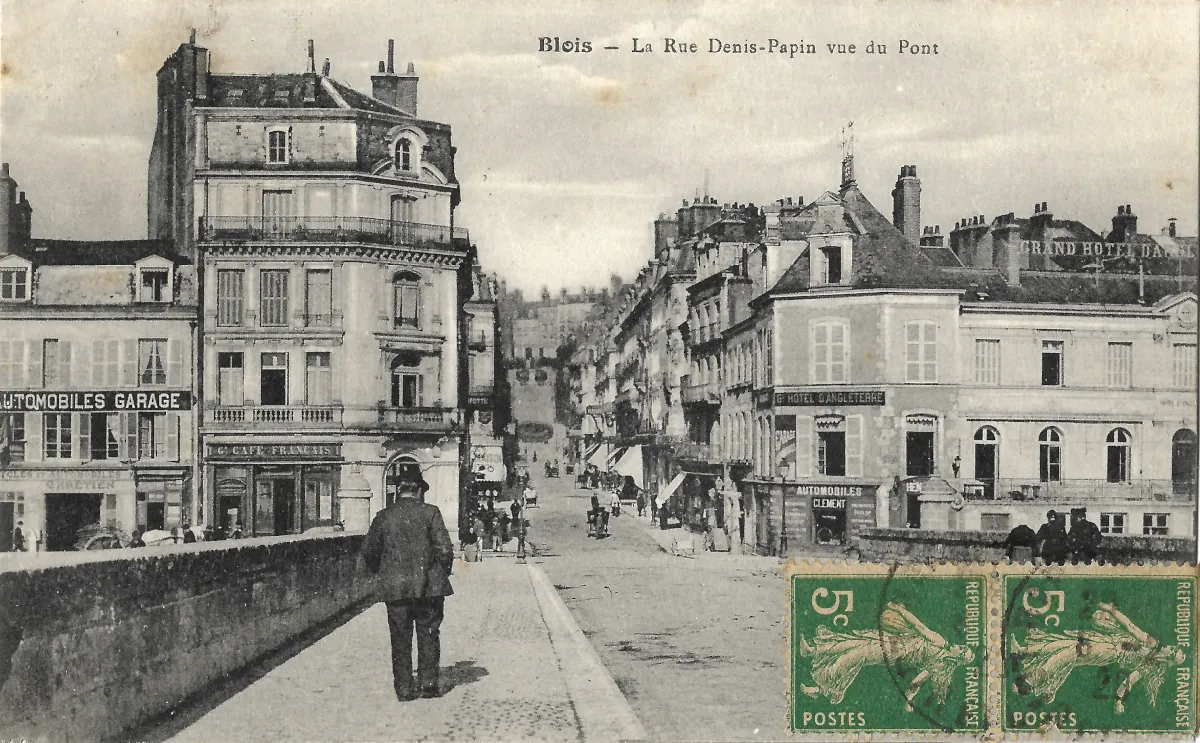
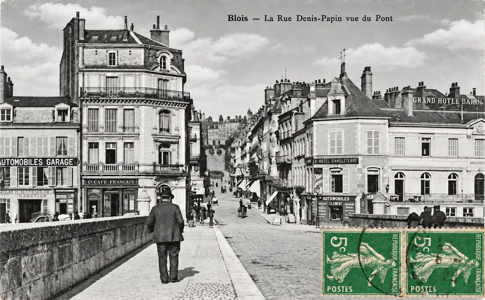
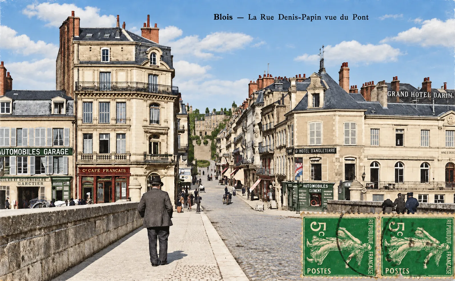
Rue Denis-Papin in Blois, seen here from Jacques-Gabriel Bridge, forms one of the most striking urban perspectives in the historic centre of the city. The photograph looks from the bridge towards the north bank of the Loire and the centre of Blois. This alignment was deliberately created during the nineteenth century: Rue Denis-Papin was laid out between 1862 and 1865 to improve access between the bridge, the lower town and the higher districts. It subsequently became one of the main commercial streets in central Blois.
The stone parapets of Jacques-Gabriel Bridge occupy the foreground, while the road leads almost directly into Rue Denis-Papin. Built between 1717 and 1724 to plans by Jacques V Gabriel, the bridge was a major element in the eighteenth-century reorganisation of communications across the Loire. Its position later provided the natural axis for the nineteenth-century street visible in this postcard.
The entrance to the street bears little resemblance to the modern bridgehead. On the left, the sign “Le Café Français” can be clearly read across the ground floor of a substantial corner building. Next to it, an “Automobiles Garage” sign illustrates the growing importance of motor transport. On the opposite side stands the Hôtel d’Angleterre, its name displayed prominently on the façade, while a large rooftop advertisement refers to the “Grand Hôtel d’Angleterre”. At street level, another sign reads “Automobiles Clément”.
Together these businesses reveal the mixed character of the area. Travellers arriving across the bridge immediately encountered hotels, cafés, shops and businesses connected with the emerging automobile trade. The bridgehead was therefore not merely a road junction but an important commercial gateway to Blois.
Rue Denis-Papin rises gently away from the Loire between continuous rows of multi-storey buildings. Shops occupy many of the ground floors, several protected by projecting awnings. Pedestrians and small vehicles animate the street, creating the impression of a busy urban thoroughfare rather than a quiet residential district. Its relatively broad, straight layout contrasts with the narrower streets inherited from the older fabric of Blois.
At the upper end of the perspective lies the area of the monumental Denis-Papin staircase. The staircase was created as part of the nineteenth-century project to connect the lower town with the plateau above, and the statue honouring Denis Papin was installed there in 1880.
The view is particularly valuable because much of this streetscape later disappeared. Bombing in 1940 destroyed a substantial part of the buildings in and around Rue Denis-Papin. Post-war reconstruction radically redesigned the bridgehead, producing a much more open arrangement around what is now Place de la Résistance. The postcard therefore preserves a street scene that can no longer be experienced in its original form.
Historical description
This postcard shows Rue Denis-Papin in the early twentieth century, during a period when transport, commerce and everyday life in Blois were changing rapidly. The street itself was still a relatively recent addition to the city. Although first envisaged in 1848, it was opened between 1862 and 1865 under Mayor Eugène Riffault. Originally named Rue du Prince-Impérial during the Second Empire, it was renamed Rue Denis-Papin at the end of 1870.
The street and the monumental staircase beyond it were part of a deliberate urban planning scheme intended to create a direct connection from Jacques-Gabriel Bridge towards the upper town. Architect Jules de La Morandière was responsible for the staircase project. The ensemble took shape during the 1860s and was later enhanced by Aimé Millet’s statue of Denis Papin, inaugurated in 1880.
Several visual details suggest that the photograph belongs to the opening decades of the twentieth century. Most striking are the signs connected with the new automobile trade. A garage is advertised on the left, while “Automobiles Clément” appears beside the Hôtel d’Angleterre on the right. These businesses coexist with older urban institutions such as cafés and hotels, illustrating the transition from the nineteenth-century city of horse-drawn travel towards the motorised world of the twentieth century. Other surviving postcards document the Clément business and the Hôtel d’Angleterre in the same part of Blois during the early 1910s.
The two green French 5-centime Semeuse stamps attached to the lower-right corner provide another useful chronological clue. They appear to be the green 5 c Semeuse type placed on general sale in March 1907 and withdrawn in July 1921. If that identification is correct, the postal use of this particular card falls within that general period. The stamps do not, however, establish the exact date on which the original photograph was taken, since postcard publishers could continue selling an older view for several years.
A date in the late 1900s or early 1910s therefore appears plausible for the scene, but the image alone does not justify assigning a precise year.
The historical importance of the postcard is strengthened by what happened to this district during the Second World War. In 1940, bombing caused extensive destruction in the centre of Blois, including much of the built frontage around Rue Denis-Papin. Reconstruction plans subsequently sought to open up the bridgehead and improve traffic circulation. The resulting Place de la Résistance and surrounding buildings created a significantly different urban landscape.
The postcard consequently records more than a picturesque street scene. It captures the former gateway to central Blois at a moment when nineteenth-century architecture, traditional cafés and hotels were beginning to share the city with garages and motor vehicles. It is also a valuable record of a streetscape largely erased by wartime destruction and post-war reconstruction.