Blois – Jacques-Gabriel Bridge over the Loire
Geographic description
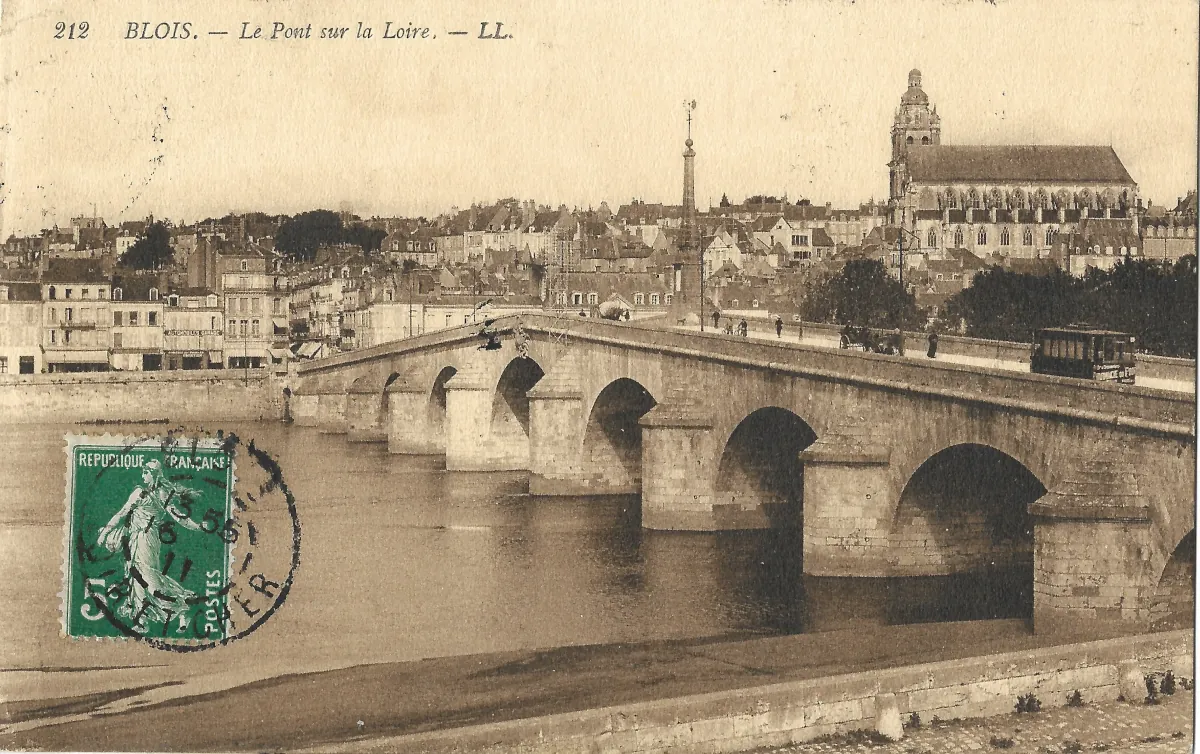
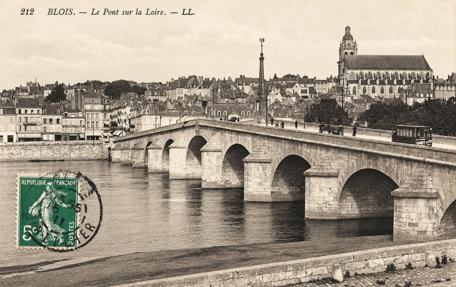
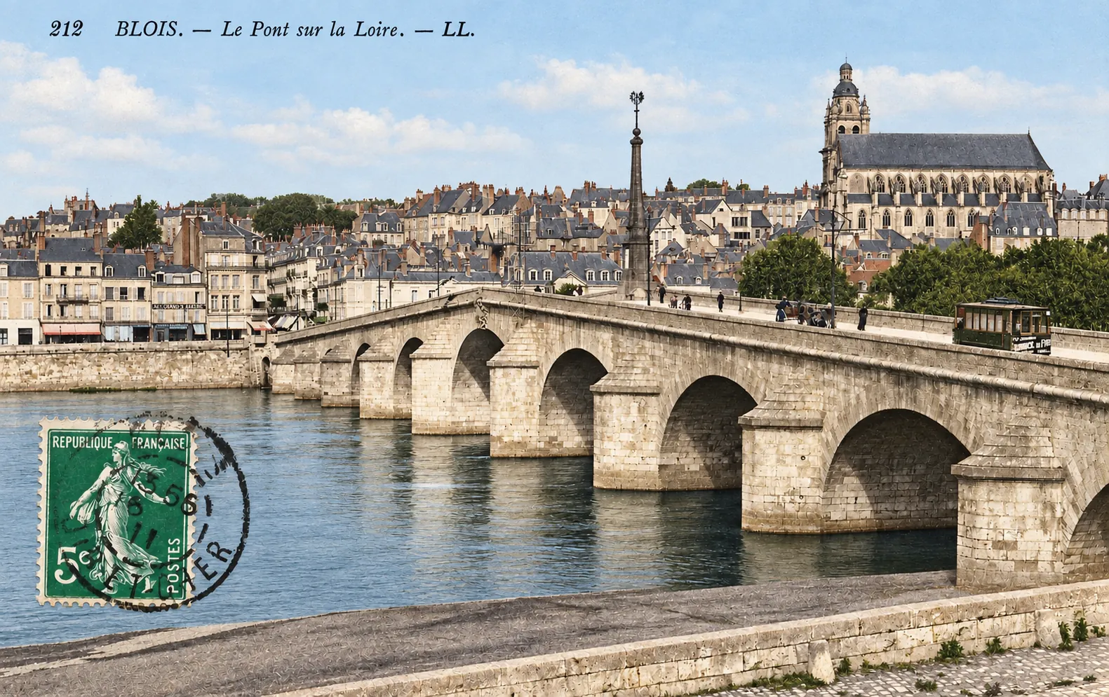
The Jacques-Gabriel Bridge in Blois dominates the foreground of this vintage postcard, photographed from the left bank of the Loire in the Vienne district toward the historic centre on the opposite bank. The viewpoint emphasizes the bridge’s distinctive rising profile while the old town climbs the hillside behind it.
Built of dressed stone, the bridge consists of eleven arches arranged symmetrically around the central span. Its pronounced hump-backed profile is clearly visible in the photograph. At the centre of the bridge stands the tall stone pyramid that marks its highest point; the Blois municipal archives identify this monument as the work of sculptor Guillaume Coustou.
Several of the bridge’s arches and massive piers fill the foreground, while pedestrians move along the roadway and pavements. A horse-drawn vehicle can be seen to the right. Most strikingly, an electric tram is crossing the bridge. The simultaneous presence of a tram and horse-drawn traffic captures a period when modern urban transport was beginning to coexist with older forms of mobility.
Beyond the Loire, the historic town forms a dense background of closely packed houses and buildings with predominantly slate roofs. Commercial premises line the riverside near the bridgehead. The words “Automobiles Garage” can even be read on one of the buildings, an evocative detail reflecting the growing importance of motor vehicles during the early twentieth century.
Rising prominently on the right is Blois Cathedral, Saint-Louis. Its long Gothic body and large windows are dominated by the distinctive bell tower capped by a dome. The building incorporates several periods of construction, including work from the twelfth and sixteenth centuries. After a violent storm caused major damage in 1678, much of the church was rebuilt during the late seventeenth century. The former church of Saint-Solenne became Saint-Louis Cathedral following the creation of the Diocese of Blois in 1697.
The postcard therefore provides an excellent illustration of the relationship between Blois and the Loire. The bridge acts as the principal link between Vienne on the left bank and the historic centre on the right bank, while the older city rises above the river. The bridge, cathedral, quays and hillside neighbourhoods combine to form a highly recognizable urban landscape centred on the crossing of the Loire.
Historical description
The bridge shown on the postcard is today’s Jacques-Gabriel Bridge. It was constructed between 1717 and 1724 following the collapse of Blois’s medieval bridge, which had been severely damaged during the icy breakup of the Loire in the winter of 1716. The replacement bridge was designed by Jacques V Gabriel, architect to the royal administration and First Engineer of Bridges and Roads. The Blois archives describe it as one of the earliest major modern bridges over the Loire, although it retained the strongly arched profile inherited from earlier bridge design.
The tram visible in the photograph provides an unusually useful dating clue. Blois introduced its electric tramway network in 1910. One of its routes linked the Saint-Gervais toll point with the Paris-Orléans railway station, crossing the Loire and serving the centre of Blois. The urban tram system remained in operation until 1933. The presence of a tram on the bridge therefore establishes 1910 as the earliest plausible date for this particular view.
A separately documented copy of the identical postcard, carrying the same caption and catalogue number “212 BLOIS. – Le Pont sur la Loire. – LL.”, contains correspondence dated 19 February 1916. This confirms that the edition was already circulating by that date. Taken together, the tram and this documented example make the early 1910s, approximately 1910–1916, a reasonable dating range for the photograph.
The initials LL printed after the caption are associated with the Lévy publishing house, one of the major Paris-based producers of photographic postcards. Museum collections contain many cards carrying the same LL signature.
The postcard is also significant because it records the bridge and its surroundings before the destruction of the Second World War. In June 1940, one arch was blown up by the French army in an attempt to delay the German advance. In August 1944, retreating German forces destroyed three central arches. The damaged sections were subsequently rebuilt.
The northern bridgehead and the surrounding lower town also changed considerably after wartime destruction. Reconstruction reshaped this part of Blois and led to the development of the present Place de la Résistance. As a result, part of the dense streetscape visible immediately beyond the bridge belongs to a section of pre-war Blois that no longer survives in the same form.
The postcard therefore captures Blois at a particularly revealing moment: an eighteenth-century stone bridge still embedded in its older urban surroundings, a newly introduced electric tram crossing the Loire, horse-drawn traffic remaining in everyday use, and Saint-Louis Cathedral dominating the skyline. It is both a picturesque view of the city and a valuable record of the transition between the traditional nineteenth-century town and the increasingly mechanized urban world of the early twentieth century.