Chablis – Faubourg de la Maladière and Rue de l’Orme
Geographic description
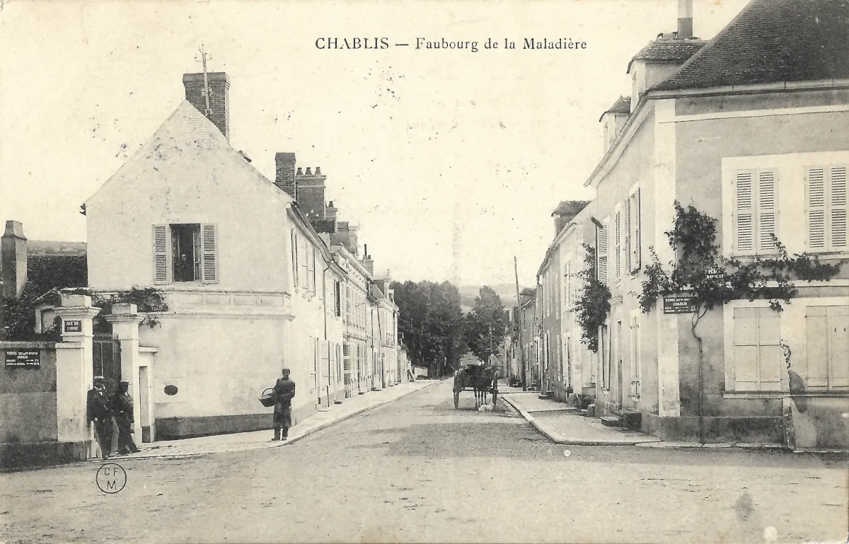
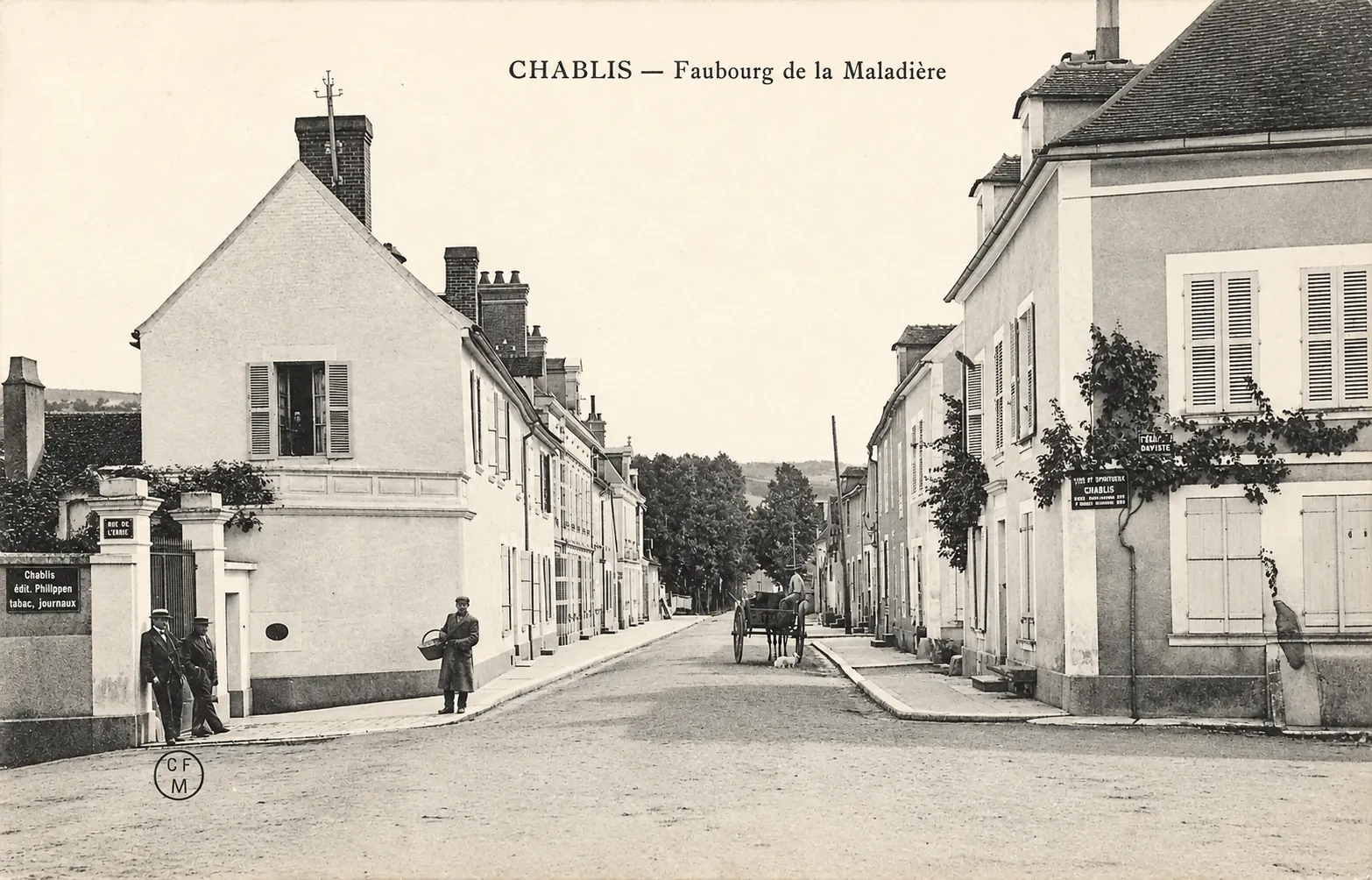
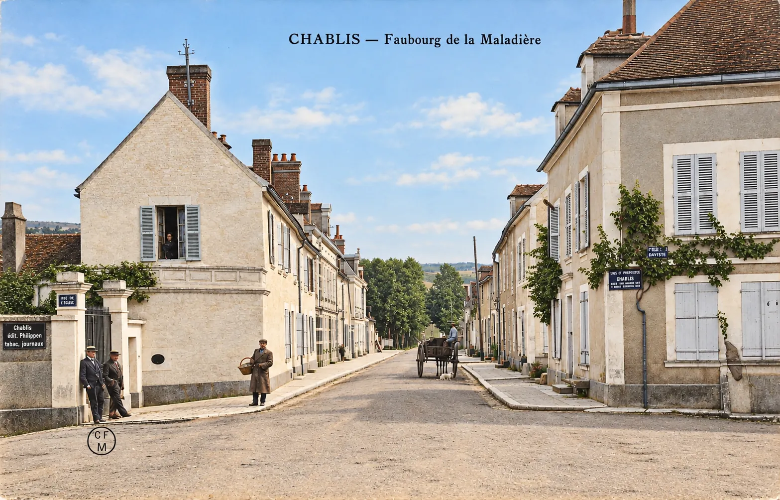
The Faubourg de la Maladière in Chablis is shown in this old postcard as a quiet residential district built along a broad street lined with traditional houses. The printed caption at the top of the card, “CHABLIS — Faubourg de la Maladière,” provides a clear identification of the location.
Chablis lies in the Yonne department of Burgundy, in the Serein valley, surrounded by the vineyards that have made its name internationally famous. Official information about the Chablis wine region confirms that the vineyard lies close to Auxerre and follows the valley of the River Serein.
One particularly valuable detail can be read on the left-hand side of the postcard. A street sign clearly says “RUE DE L’ORME.” This makes it possible to relate the historical photograph to the changing street plan of Chablis. A local historical study explains that the former Rue des Tanneries was later called Rue de l’Orme before becoming the present-day Avenue Jean-Jaurès. The nearby Impasse de l’Orme still preserves the old name.
The same historical source records that the old Chaussée Saint-Sébastien in the Maladière district was subsequently known as the Rue du Faubourg de la Maladière and is now Avenue d’Oberwesel. The postcard therefore preserves valuable evidence of the earlier street names of this part of Chablis.
The built environment is modest and relatively open. Rows of attached or closely spaced houses, generally one or two storeys high, follow the line of the street. Rendered façades, shuttered windows, tiled roofs and substantial chimney stacks give the scene the appearance of a small Burgundian town at the beginning of the twentieth century. Climbing plants can be seen growing against some of the buildings, softening the otherwise plain façades.
The road surface appears to be compacted or only lightly paved. Raised pavements have nevertheless already been provided on both sides, indicating that this was an established urban street rather than a simple rural track. Utility poles and overhead wires are also visible farther along the road.
The scene contains only a handful of people, but their presence adds considerable historical interest. Several inhabitants stand near the houses or along the pavement, while a horse-drawn cart occupies the centre of the street. No motor vehicle can be seen. Horse transport therefore still appears to have been a normal part of everyday activity when the photograph was taken.
Beyond the buildings, the street leads towards trees and the gently rising terrain around Chablis. The town remains visually connected with the surrounding countryside, although individual vineyard plots cannot be identified with certainty in this particular view.
Historical description
The name Maladière has a much older origin than the postcard itself. Local historical research explains that the former Chaussée Saint-Sébastien took its name from a chapel connected with a maladrerie, situated near the foot of the Côte des Clos. Such establishments were traditionally located outside the main inhabited area and were used to isolate and care for people suffering from contagious diseases.
The district therefore developed on what had originally been the outskirts of the town. Historical information about the former Route Nationale 65 also describes travellers leaving Chablis through the Faubourg de la Maladière before climbing away from the town, confirming the importance of this area as one of Chablis’s traditional approaches.
The postcard probably dates from the early decades of the twentieth century, possibly from the years before or around the First World War. This remains an estimate because no postal cancellation or dated reverse has been provided. Several visual clues nevertheless support such a period: the horse-drawn vehicle, the clothing worn by the figures, the complete absence of motor traffic, the form of the street and the general photographic and printing style.
A circular C.F.M. mark is visible in the lower left corner of the postcard. This initials mark is recorded as belonging to Chartier Frères of Montargis, publishers of numerous French picture postcards during the early twentieth-century postcard era. The publisher identification is therefore consistent with the proposed dating, although it does not establish an exact year.
The postcard is especially valuable because the street names recorded in the image have since changed. The Faubourg de la Maladière became Avenue d’Oberwesel, while the Rue de l’Orme visible on the left was an earlier name associated with what is now Avenue Jean-Jaurès. The photograph therefore documents not only the appearance of the neighbourhood but also the evolution of Chablis’s urban place names.
Chablis itself has a long-established urban history. Fortifications were built around the lower town in the early fifteenth century, while settlement outside the historic core developed along the approaches to the town. The history of Chablis is also inseparable from its vineyards, whose growth and reputation were strongly influenced by religious communities during the Middle Ages.
This postcard thus records more than an ordinary street scene. It captures a transitional zone between the historic town, its outer suburbs and the surrounding countryside at a time when horse-drawn transport, modest residential buildings and lightly developed roads still shaped everyday life in Chablis.