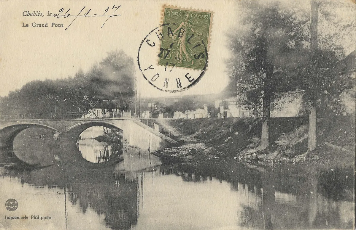
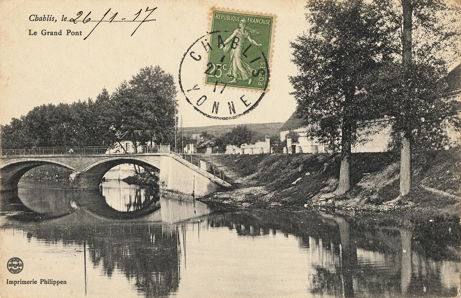
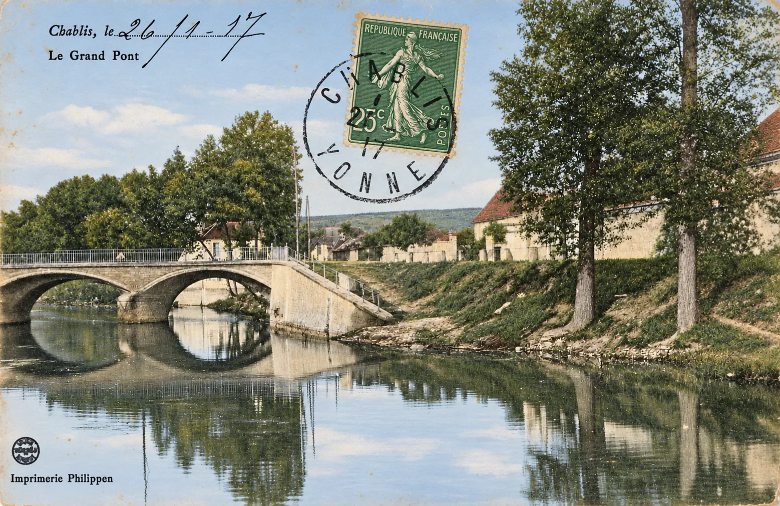
Chablis – The Grand Pont over the Serein in 1917
Geographic description
The Grand Pont in Chablis crosses the River Serein in the historic landscape of this small town in the Yonne department of Burgundy, near Auxerre. The river is one of the defining geographical features of the Chablis area, running through the valley around which the famous vineyards developed. Official information on the Chablis wine region confirms the close relationship between the vineyards and the Serein valley.
The postcard is explicitly captioned “Le Grand Pont”. The stone bridge dominates the left and central parts of the photograph. Several masonry arches can be seen crossing the river, with three openings discernible in the composition, although the westernmost one is partly cut off by the edge of the image. A solid parapet runs along the bridge deck, while a sloping path or access way descends towards the riverbank on the right.
The Serein is exceptionally calm in this view. Its surface reflects the bridge arches, trees and riverbanks, creating one of the most attractive features of the photograph. The surroundings are still remarkably open. Large mature trees stand beside the river on the right, with grassy banks and only a limited number of buildings visible farther back.
This makes the postcard particularly interesting from a geographical point of view. Modern Chablis is internationally associated with wine, yet there are no obvious vineyards, wine houses or cellars in the photograph. Instead, the image presents the town through its river landscape and an important crossing point.
There are also no clearly visible motor vehicles, carts or significant groups of pedestrians. The bridge therefore appears less as a busy traffic route than as part of a quiet semi-rural landscape. This may simply reflect the moment at which the photograph was taken, but it gives an impression of the modest scale of Chablis in the early twentieth century.
The Serein remains inseparable from the geography of the wine region. The celebrated slopes surrounding Chablis extend along its valley, while the Grand Cru vineyards occupy the right bank to the northeast of the town. Historically, a bridge at this location therefore served not only the inhabitants of the town itself but also communications between Chablis, its outskirts and the roads leading towards the surrounding villages and vineyard slopes.
Historical description
This particular postcard can be dated unusually closely because of the handwritten inscription at the upper left: “Chablis, le 26/11/17.” It can very reasonably be interpreted as 26 November 1917. The inscription dates the use or sending of this particular card, however, rather than necessarily the original photograph. The image may have been produced somewhat earlier.
The green five-centime French Republic stamp and the circular postal cancellation clearly bearing “CHABLIS – YONNE” are also consistent with an early twentieth-century postcard. At the lower left, the printed credit “Imprimerie Philippen” can be read clearly. The name can therefore safely be identified as the printer’s mark appearing on the card, although available reliable sources do not provide enough evidence to reconstruct the history of this printing business without speculation.
The river crossing itself has a much longer history. A local history of Chablis published by L’Yonne Républicaine records an earlier wooden bridge associated with the reign of Saint Louis. In 1331, Miles V, lord of Noyers, ordered the construction of a three-arched stone bridge, modelled on the bridge at Auxerre. The structure was rebuilt at a later date. The official historical account of the Chablis wine region likewise records work on an arch of the bridge in 1331, confirming the medieval origins of the crossing.
This does not mean that all the masonry visible in the 1917 photograph dates from the fourteenth century. The crossing and its three-arch tradition have documented medieval origins, but the bridge underwent later rebuilding and alterations. The postcard should therefore be viewed as an early twentieth-century stage in the long architectural history of the site rather than as a photograph of an untouched medieval bridge.
Later events give the image additional historical significance. On 15 June 1940, during the bombing of Chablis, bombs severed the bridge. The same attack damaged a water main supplying the town, seriously complicating efforts to fight the fires that subsequently devastated part of lower Chablis.
The postcard consequently preserves the appearance of the Grand Pont more than twenty years before the destruction of 1940. Although the handwritten date places the card in the middle of the First World War, nothing in the scene itself suggests conflict: the Serein is still, the banks are shaded by trees, and the old stone bridge stands quietly across the river. It is both a peaceful landscape photograph and a record of a crossing whose history stretches from medieval Chablis into the upheavals of the twentieth century.