Orléans – Place du Martroi and Rue de la République
Geographic description
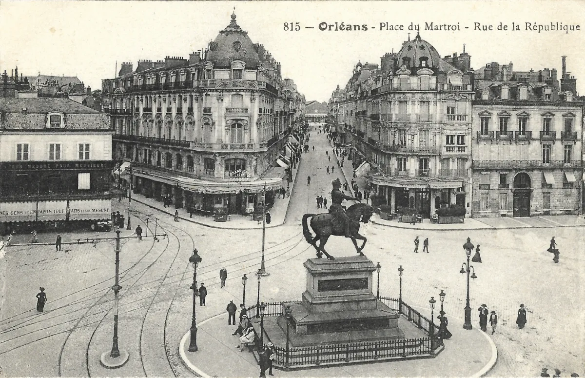
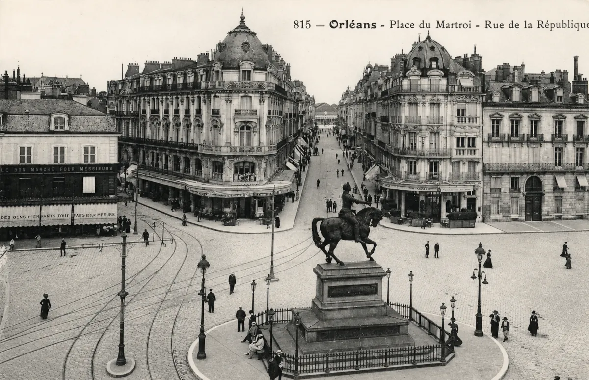
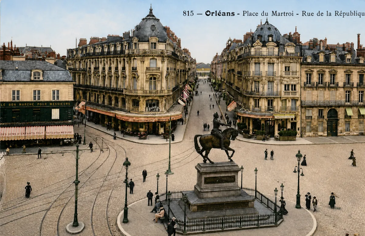
The Place du Martroi in Orléans is shown here in a remarkable elevated panoramic view, with the equestrian statue of Joan of Arc in the foreground and Rue de la République stretching away behind it. The printed caption at the top clearly identifies the scene: “815 – Orléans – Place du Martroi – Rue de la République.” The camera is looking north along the avenue leading from the central square towards Orléans railway station.
The photograph clearly illustrates the importance of Place du Martroi as one of the city’s principal urban crossroads. Joan of Arc’s monument occupies the centre of a broad open space. The bronze equestrian figure stands on a massive pedestal surrounded by an ornamental iron railing, while elaborate street lamps are distributed around the square.
Beyond the monument, Rue de la République forms a strong central perspective. Two particularly imposing buildings frame its entrance from the square, almost creating a monumental gateway. Their elaborate stone façades, balconies, cornices and high slate roofs are characteristic of the eclectic architecture favoured in France during the late nineteenth century. The rounded corner sections crowned by prominent roofs were deliberately designed to emphasise the entrance to the street.
Municipal planning documents confirm that Rue de la République was conceived as a Haussmann-style urban development. It was approximately 17 metres wide, while its major intersections were highlighted by cut-off corners and rounded façades crowned with ribbed slate domes. The buildings visible on this postcard are therefore not simply an attractive backdrop: they formed part of a carefully planned urban composition intended to give Orléans a more modern and prestigious appearance.
The long straight street is lined by continuous rows of buildings that draw the eye towards the railway station. On the edges of the square, however, lower and apparently older structures can still be seen. This contrast makes the postcard especially interesting, since it records the coexistence of the older urban fabric with the ambitious redevelopment carried out around 1900.
The extensive tramway infrastructure is another striking feature. Several sets of rails curve across the foreground and through the square, showing how Place du Martroi functioned as a major junction in the city’s public transport system. Overhead poles and electric wires can also be distinguished, although no tramcar happens to be passing when the photograph was taken. Orléans opened its first tramway line in 1877, initially using horse traction, and the system was electrified in 1899. By 1909, four lines were operating and intersected at Place du Martroi.
The square itself appears surprisingly open by modern standards. Pedestrians cross the tracks and roadways freely, and no clearly identifiable motor car can be seen. Horse-drawn vehicles still appear to be present near some of the shops. The many awnings and commercial façades at street level also demonstrate the importance of retail activity around both the square and Rue de la République.
The postcard therefore provides an unusually clear view of central Orléans at the beginning of the twentieth century: a monumental civic square centred on Joan of Arc, crossed by electric tramways and connected to the railway station by one of the city’s most ambitious modern boulevards.
Historical description
This photograph was probably taken around 1905-1914, although this remains an approximate dating. Without a postmark, publisher’s date or other information from the reverse, a precise year cannot be established.
Rue de la République provides one of the strongest chronological clues. Its construction formed part of the major urban redevelopment of Orléans during the late nineteenth century. As railway travel became increasingly important, the city wanted a prestigious and direct connection between the railway station and Place du Martroi. The new street was cut through the existing urban fabric between 1894 and 1905, extending for approximately 412 metres. It was deliberately planned as both a major traffic route and an elegant commercial avenue that would present travellers arriving by train with the image of a modern city.
By the time this postcard was photographed, the development appears essentially complete. The imposing buildings lining the street are already in place, producing the coherent architectural character that remains one of the avenue’s distinctive features. Around 1902, the railway station itself received a new southern façade giving direct access to the newly created Rue de la République.
The tramway equipment provides additional evidence for an early twentieth-century date. Orléans had possessed a horse-drawn tramway since 1877, but electric operation began in 1899. The overhead electrical infrastructure visible in the postcard therefore places the photograph after this transformation. By 1909 the network had expanded to four lines, all meeting at Place du Martroi. The clothing of the pedestrians, the continued presence of horse-drawn traffic and the apparent scarcity of automobiles are also consistent with the years before the First World War, although these visual clues cannot by themselves establish an exact date.
The equestrian monument dominating the foreground predates the street by several decades. It represents Joan of Arc giving thanks, created by French sculptor Denis Foyatier. An earlier monument by Edme Gois had been erected in 1804, but it was eventually considered insufficiently imposing. Foyatier’s monumental bronze equestrian statue replaced it and was inaugurated on 8 May 1855 during Orléans’ traditional celebrations honouring Joan of Arc.
According to the French Ministry of Culture’s heritage database, Foyatier received the commission in 1846 and completed his models in 1850. The statue itself was cast in 1853 by the Fonderies de Saint-Denis, using metal that included nine cannons supplied by the Ministry of War. It was inaugurated in 1855 before every element of the final monument had been completed. The series of reliefs illustrating episodes from Joan of Arc’s life was subsequently created by Vital-Dubray and installed in 1860 and 1861.
Place du Martroi itself has much older origins. The site lay north of the medieval walls of the Orléans known to Joan of Arc and gradually developed into one of the city’s principal public spaces. During the nineteenth century, and especially with the opening of Rue de la République and the expansion of the tramway network around 1900, the square became an increasingly important commercial, civic and transport hub.
This postcard consequently captures Orléans at an important moment of transition. The monumental planning ideals of the nineteenth century are already fully visible, while electric public transport and a newly developed commercial boulevard announce the modern city. At the same time, horse-drawn traffic and the relatively relaxed use of the square still belong to an earlier urban world. It is precisely this coexistence that gives the photograph much of its historical interest.