La Mulatière – The Rhône and Saône Confluence
Geographic description
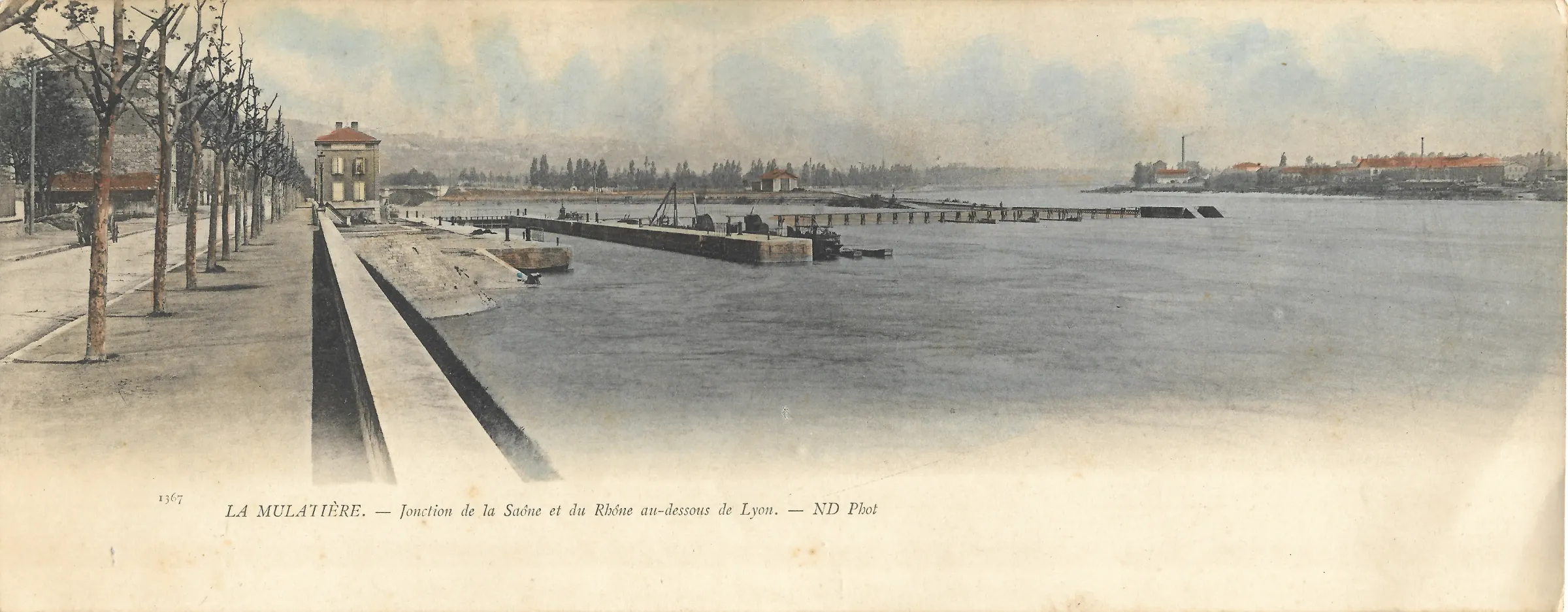
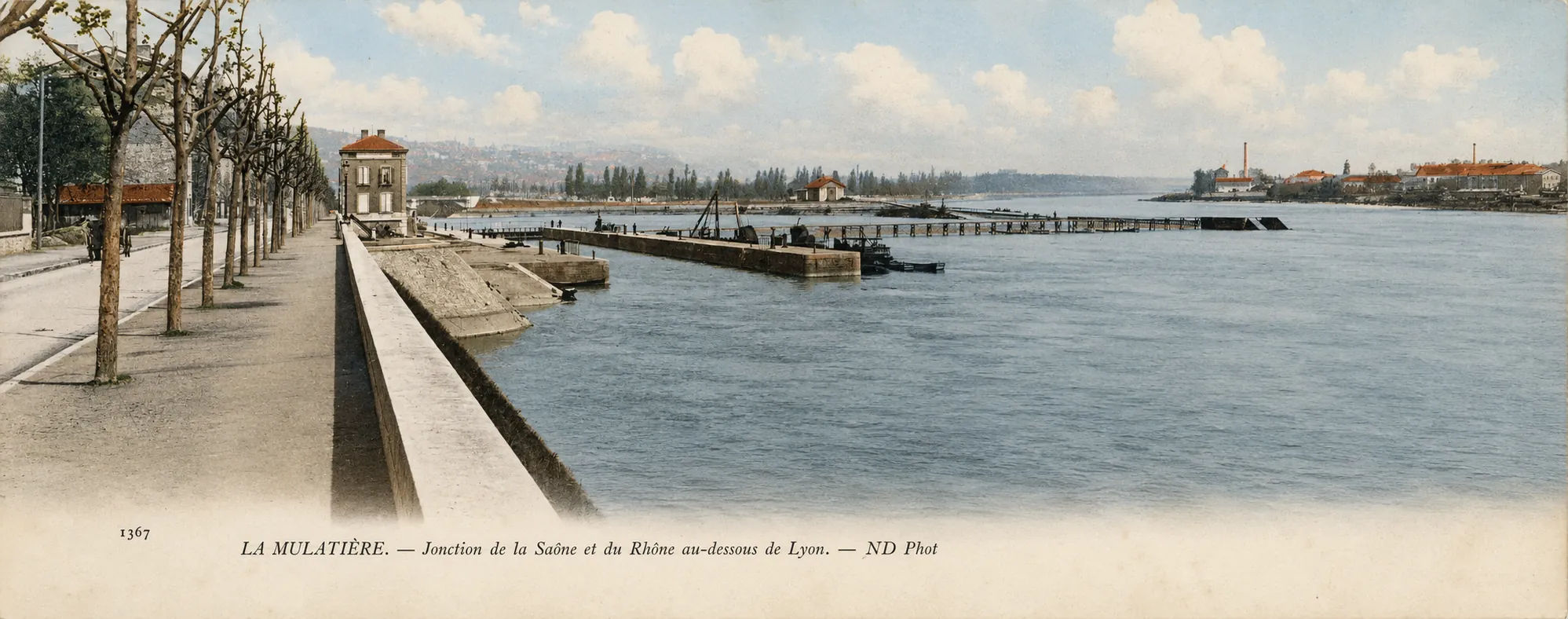
La Mulatière at the Rhône-Saône confluence appears here in a wide river panorama taken just south of Lyon. The printed caption reads: “LA MULATIÈRE. — Jonction de la Saône et du Rhône au-dessous de Lyon. — ND Phot.” The French expression “au-dessous de Lyon” means downstream from the historic city. La Mulatière occupies a distinctive geographical position where the Saône reaches the Rhône, opposite the southern end of Lyon’s peninsula. Today, the municipality still lies beside the confluence, facing Lyon’s modern Confluence district and close to Gerland.
The photograph was most probably taken from the La Mulatière side, slightly downstream from the meeting of the rivers and looking back towards the confluence. Along the left edge of the scene, a long riverside promenade stretches into the distance. Regularly spaced, heavily pruned trees line the roadway or walkway, while a substantial masonry wall separates it from the water. The riverbank is strikingly open compared with the densely developed and heavily engineered landscape found here today.
A detached building with a reddish roof stands near the water, but the main feature lies farther out in the river. The masonry platforms, narrow walkways and metal structures visible in the middle distance very probably belong to the La Mulatière lock-and-weir complex, built on the lower Saône immediately before it entered the Rhône. This interpretation matches both the postcard caption and the known layout of the historic hydraulic works. Regional heritage records list numerous early twentieth-century postcards showing the La Mulatière lock, weir and the tip of the confluence from similar viewpoints.
Water dominates the composition. Human activity is almost absent, and the technical structures seem small against the broad surface of the river. On the opposite bank to the right, low industrial buildings and several chimneys can be distinguished through the haze. They probably belong to the developing districts on the eastern side of the Rhône, towards Gerland, although this particular identification should remain more cautious than the identification of La Mulatière and the confluence itself.
The geography visible in the postcard was already partly artificial. The Rhône and Saône had not always met at this location. In the eighteenth century, their confluence lay farther north, near Ainay. Beginning in the 1770s, Michel-Antoine Perrache’s ambitious scheme for extending Lyon southwards involved embankments, river engineering and the gradual relocation of the confluence towards La Mulatière. Those works eventually created much of the southern part of the Lyon peninsula.
The difference between this historic landscape and the present-day area is considerable. The southern tip of the peninsula is now occupied by the Confluence redevelopment district and the Musée des Confluences, while roads, railway infrastructure and later urban construction have profoundly altered the La Mulatière riverfront. The postcard therefore preserves a valuable view of a time when this part of Lyon was defined primarily by waterways, navigation and hydraulic engineering rather than by modern urban architecture.
Historical description
The postcard can reasonably be dated to the early twentieth century, probably around 1900-1910, although the front alone does not allow a precise year to be established. Several clues support this approximate dating: the style of the layout, the large pale area beneath the photograph, the restrained colouring of the printed image, and above all the publisher’s mark “ND Phot.”
“ND Phot.” was used by Neurdein Frères, one of the major French photographic and postcard publishing firms of the period. The Musée d’Orsay specifically records “ND Phot” as an alternative name used by Neurdein Frères and dates the firm’s activity from 1863 to 1917. Étienne and Louis-Antonin Neurdein produced an enormous photographic record of French towns, monuments and landscapes, and their signature is found on many surviving postcards from the Belle Époque.
The proposed date also agrees well with archival evidence relating to the Lyon confluence. The regional heritage inventory lists several postcards showing the Rhône-Saône confluence from around 1900, as well as a view entitled “Jonction du Rhône et de la Saône” dating from about 1912. It also records Lyon postcards published by ND Phot during the first quarter of the twentieth century. The present postcard therefore fits naturally within this period of intensive postcard production.
By the time the photograph was taken, La Mulatière was already an independent municipality. The area had previously belonged to Sainte-Foy-lès-Lyon but became a separate commune in 1885, following substantial demographic, industrial and transport-related development during the nineteenth century. Its position beside two major waterways and important railway installations gave it far greater economic significance than its relatively small size might suggest.
The La Mulatière weir was one of the major pieces of infrastructure shaping this river landscape. Lyon’s municipal archives date its construction to 1878-1881, while surviving engineering drawings of the lock-and-weir complex date from 1880. The installation helped regulate water levels on the lower Saône so that navigation could continue more reliably, and vessels used the adjoining lock to pass the barrage before entering or leaving the Rhône. By the early twentieth century, it was therefore an established part of Lyon’s river transport system.
The installation remained in service for many decades. The weir was finally demolished in 1966 after later river-control works made it obsolete; the Lyon municipal archives specifically record its demolition on 19 March 1966. The lock itself survived and part of the former structure can still be recognised today.
This postcard is consequently more than a picturesque view of two rivers meeting. It records a highly engineered landscape at a crucial point in Lyon’s transport network, when river navigation, locks, weirs, industrial activity and railway development all converged around La Mulatière. Its remarkably quiet appearance therefore conceals a site that played an important role in the economic and geographical development of the Lyon area.