The Jetée-Promenade and Promenade des Anglais
Geographic description
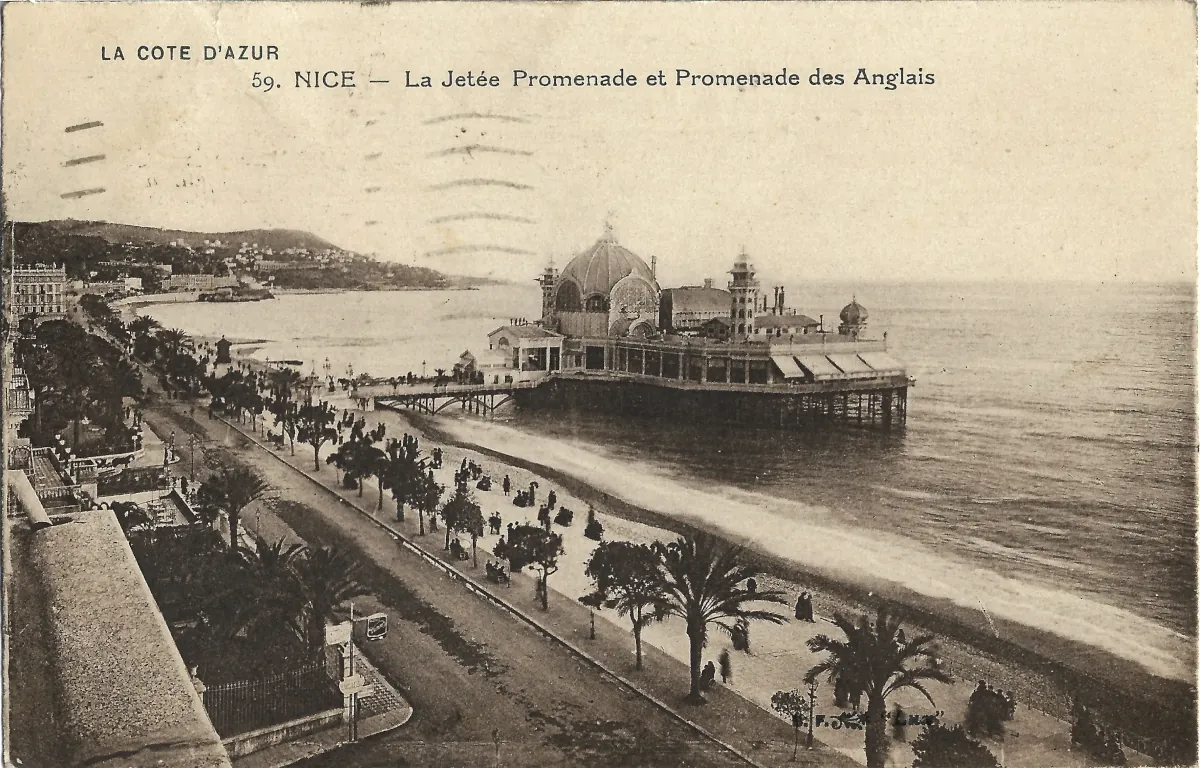
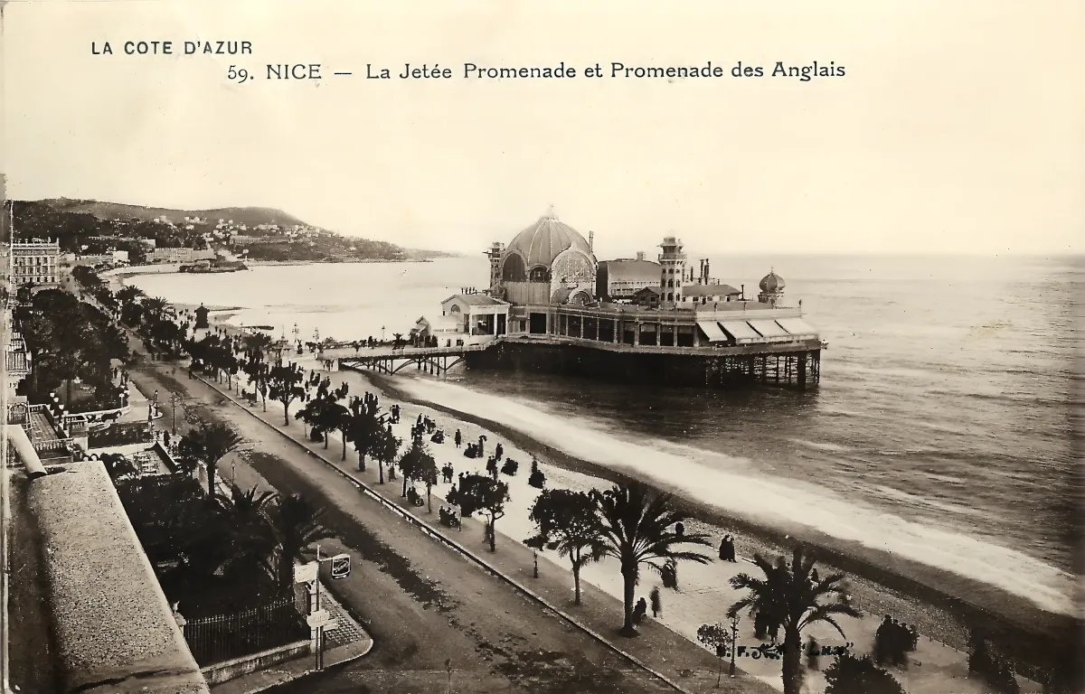
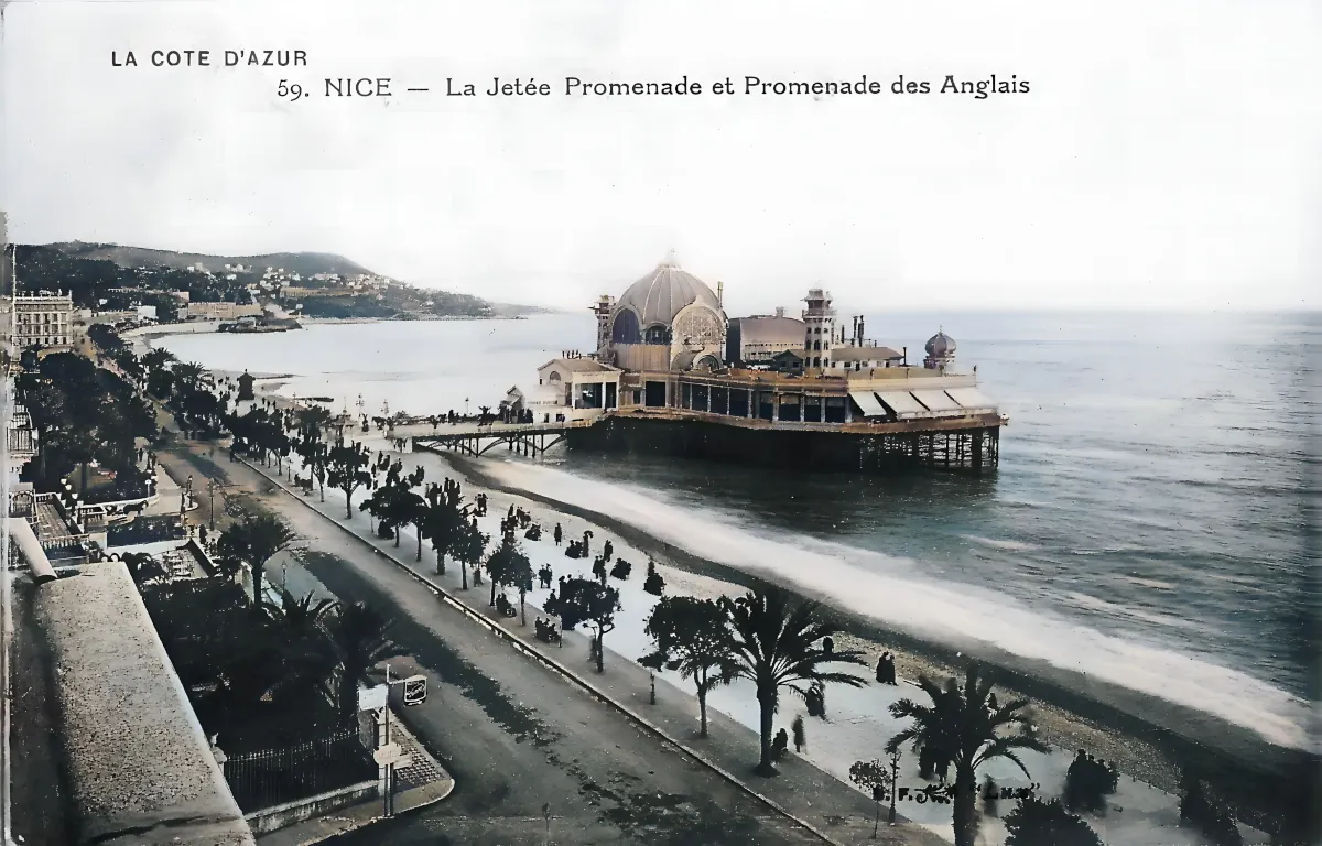
The Nice Jetée-Promenade rises dramatically above the Mediterranean in this elevated view of the celebrated Promenade des Anglais. The printed caption identifies the scene unambiguously: “59. NICE – La Jetée Promenade et Promenade des Anglais,” beneath the series heading “LA COTE D’AZUR.” Standing offshore on its large platform, the casino immediately dominates the composition and appears almost to float above the sea.
Its architecture is particularly distinctive. A monumental central dome is surrounded by several smaller towers and domed structures, while long glazed galleries extend across the seaward platform. A narrow bridge connects the complex with the shore. These features securely identify the building as Nice’s former Jetée-Promenade casino, once one of the most recognizable landmarks on the city’s waterfront. According to the City of Nice, the complex occupied a platform of approximately 6,500 square metres and was connected to the shore by a walkway about 130 metres long.
In the foreground, the Promenade des Anglais looks markedly different from the broad modern boulevard. The roadway is comparatively narrow, while a generous part of the seafront is devoted to pedestrians. Trees and palms punctuate the promenade, separating the buildings from the pebble beach and creating the planted Riviera landscape that became closely associated with Nice. The city’s World Heritage documentation emphasizes the importance of palms and other acclimatized vegetation in shaping the distinctive character of the seafront.
Numerous figures can be seen walking along the promenade, some individually and others in small groups. Their presence illustrates the boulevard’s social function: it was not merely a transport route but one of the principal stages of fashionable public life in Nice. No motor car can be identified with certainty in this reproduction. That detail cannot by itself establish a date, but the scene still conveys a period when strolling remained a central feature of the Promenade des Anglais.
The coastline curves away in the distance towards the eastern part of Nice, with the hills beyond the old town forming the background. Hotels and residential buildings already line much of the shore, illustrating the transformation of Nice into an international resort. UNESCO records that the original Camin dei Ingles, created along the coast by British winter residents in 1824, gradually developed into the Promenade des Anglais. Following Nice’s transfer to France in 1860 and its connection to the European railway network, the city attracted an increasingly international population of winter visitors.
The contrast with the present-day waterfront is considerable. The Jetée-Promenade no longer exists, while the Promenade des Anglais has been substantially widened. In 1931-1932, the roadways reserved for motor traffic were doubled and separated by a central strip, one of several changes that fundamentally altered the appearance preserved in earlier postcards such as this one.
Historical description
The history of the Nice Jetée-Promenade was almost as dramatic as the building itself. It emerged during the great period of winter tourism that transformed Nice during the nineteenth century. Inspired partly by the entertainment piers of British seaside resorts, especially Brighton, the project was intended to provide wealthy visitors with an extraordinary leisure complex built directly over the Mediterranean.
The first Jetée-Promenade was due to open on 4 April 1883, but a devastating fire destroyed it on the day before the planned inauguration. The scheme was nevertheless revived. Permission to rebuild was granted in 1889, and the Nice firm Dumontel et Tombarel undertook the reconstruction. The new casino finally opened on 10 January 1891. Its facilities included a music pavilion, concert hall and theatre, grouped beneath a central dome rising approximately twenty metres above the platform.
Those dates provide firm chronological boundaries for the photograph. The building shown here cannot predate 1891, while it cannot postdate 1944, when the Jetée-Promenade disappeared.
The visual evidence permits a somewhat narrower estimate, although not an exact date. The monochrome postcard style, the relatively modest width of the roadway, the concentration of pedestrians and the lack of clearly identifiable motor traffic are consistent with the early decades of the twentieth century, probably before the major road alterations of the 1930s. A date somewhere around 1900-1920 is therefore plausible for the original photograph, but should remain an estimate. Postcard publishers frequently continued to reproduce older photographic views, so the date of the printed card need not coincide exactly with the date on which the photograph was taken.
This was the period when Nice reached its height as one of Europe’s most fashionable winter resorts. The Promenade des Anglais became a centre of elite social life, lined with villas, hotels, gardens and entertainment establishments catering to wealthy visitors from Britain, Russia, continental Europe and the United States. The Musée Masséna notes that between the arrival of the railway in 1864 and the outbreak of the First World War, Nice’s population grew from approximately 48,000 to nearly 150,000 as the resort expanded dramatically.
The First World War brought this Belle Époque world to an abrupt halt. The Jetée-Promenade was converted for medical use during the conflict. It reopened afterwards, but its former prestige was never fully restored. Tourism itself was changing: Nice, traditionally a winter destination, increasingly attracted summer visitors interested in sea bathing and other seaside activities.
The building finally disappeared during the Second World War. In 1944, under German occupation, the Jetée-Promenade was dismantled and its materials reused for defensive works. It was never rebuilt. This postcard is therefore more than an attractive Riviera view: it preserves the appearance of a major lost landmark that once formed an integral part of Nice’s seafront skyline.
Faint curved marks resembling a postal cancellation can also be seen across the upper part of the postcard, but no date is sufficiently legible to use as evidence. Similarly, the front alone does not allow the publisher to be identified with confidence. The number 59 and the heading “La Côte d’Azur” clearly indicate a numbered series, but they are not sufficient for a secure attribution.