Brooklyn Bridge in New York circa 1910: East River Waterfront
Geographic description
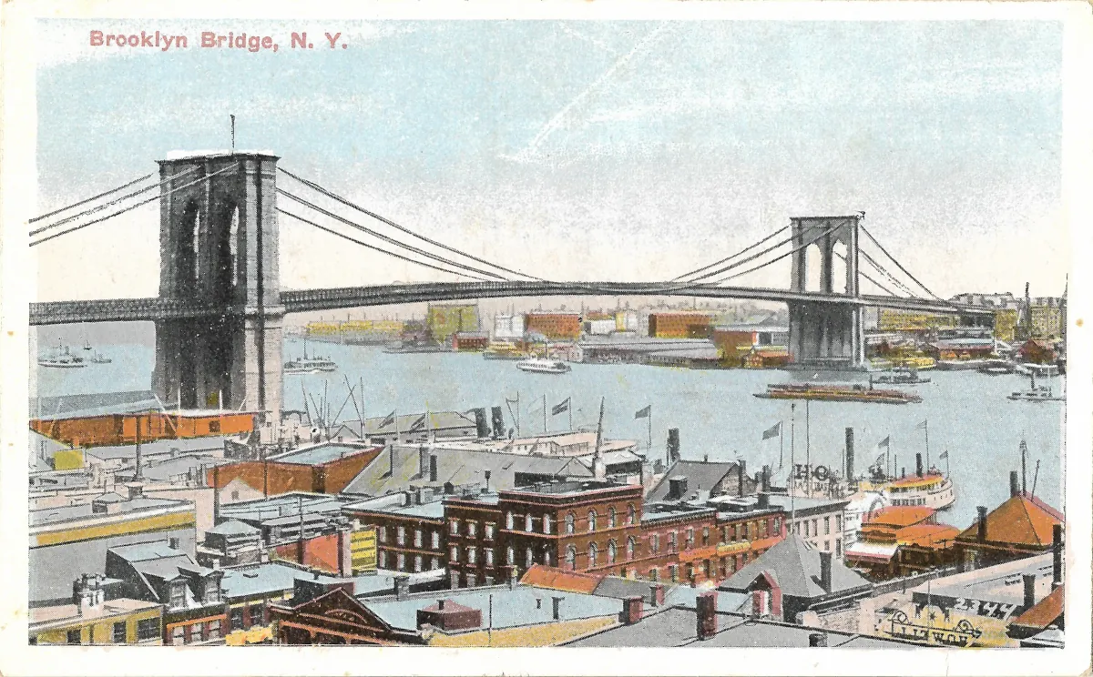
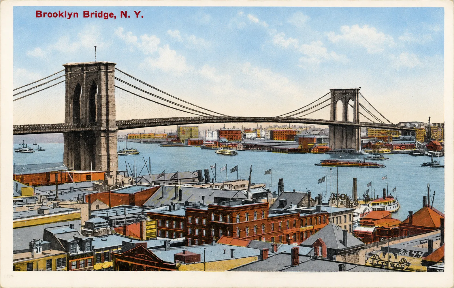
The Brooklyn Bridge in New York dominates this historic view of the East River, rising above a remarkably busy waterfront of piers, vessels, warehouses and closely packed buildings. The printed caption in the upper-left corner, “Brooklyn Bridge, N. Y.,” identifies the landmark beyond doubt.
The bridge crosses the East River between Lower Manhattan and Brooklyn. In this view, the nearest stone tower stands on the left, while the second tower appears farther away toward the right. Together with the waterfront structures filling the foreground, this perspective strongly suggests a viewpoint from the Lower Manhattan side looking toward Brooklyn. The photograph was apparently taken from an elevated position, probably a building overlooking the East River docks.
The architectural identity of the Brooklyn Bridge is unmistakable. Its massive masonry towers are pierced by tall pointed arches, giving the structure its distinctive Gothic Revival appearance. The sweeping main suspension cables descend gracefully between the towers and anchorages, while numerous secondary cables connect them to the deck. Historic American Engineering Record documentation held by the Library of Congress emphasizes the importance of John A. Roebling’s cable system and the diagonal stays used to stabilize the structure.
What makes the postcard especially valuable, however, is the waterfront beneath the bridge. The East River is portrayed not as empty scenery but as a working transportation corridor. Several vessels can be distinguished on the water. At the right foreground is a substantial passenger steamer or ferry, with multiple decks and prominent funnels, while smaller craft can be seen farther across the river.
The lower portion of the image preserves an unusually rich view of New York’s working waterfront. Brick commercial buildings, sheds, warehouses, roofs, chimneys, flagpoles and dockside structures are tightly compressed into the foreground. This dense mixture illustrates how closely maritime transportation, commerce and urban life were connected along the East River at the beginning of the twentieth century.
Across the river, Brooklyn’s waterfront is comparatively low-rise and industrial in character. Warehouses and other commercial structures line the shore behind the bridge tower. The scene therefore differs markedly from the modern image of this part of New York, where the bridge is generally photographed against dramatically transformed waterfronts and much taller skylines.
A particularly useful comparison comes from the New York Public Library. Its Digital Collections contain a postcard titled exactly “Brooklyn Bridge, N. Y.” with imagery that closely corresponds to the card shown here. The catalogue records the East River, piers and wharves as subjects and notes that the words “Hartford and Middletown Direct Line” appear on a sign within the image.
The pale blue river and sky, orange roofs and strongly emphasized red brickwork should not be interpreted as a precise photographic record of the original colours. The NYPL describes its corresponding example as a photomechanical halftone print. The colouring was therefore part of the postcard production process, designed to make the urban view more attractive to buyers.
Historical description
The postcard can be dated with reasonable confidence to around 1910. This estimate is supported by more than its visual style: the corresponding postcard catalogued by the New York Public Library is itself approximately dated 1910. The NYPL attributes it to Samuel Langdorf & Co. of New York and records that it was printed in Germany.
A small degree of caution remains necessary. Without comparing the publisher information printed on the back of this particular copy, it cannot be proven that it belongs to precisely the same printing rather than to a closely related edition using the same photograph. Nevertheless, the title and visual composition make the association highly probable.
By 1910, the Brooklyn Bridge had already been part of the New York landscape for more than a quarter of a century. Construction began in 1869 and was completed in 1883. Designed by John A. Roebling, the bridge officially opened on May 24, 1883. At the time of its completion, its main suspension span was the longest in the world.
The postcard therefore records the bridge not during its construction or immediately after its opening, but at a stage when it had become an established part of everyday New York. What remained very different from the modern city was the intense maritime activity surrounding it.
The opening of a permanent bridge between Manhattan and Brooklyn did not immediately eliminate traditional water transportation. Ferries, passenger steamers, tugboats and commercial vessels continued to crowd the East River, serving both local passengers and regional trade. The vessels and piers seen here provide direct visual evidence of this coexistence between nineteenth-century river transport and the new era of monumental fixed crossings.
That combination gives the postcard much of its historical interest. The Brooklyn Bridge represents one of the great engineering achievements of industrial America, while the foreground preserves an older waterfront economy based on docks, warehouses and steam-powered vessels. The two systems existed side by side during a period when New York was undergoing extremely rapid changes in transportation and urban development.
Much of the waterfront landscape visible here was later altered or removed as maritime activities declined, road traffic increased and the approaches to the bridge were modernized. The Brooklyn Bridge itself survived these transformations and remains the defining feature of the scene, but its urban surroundings have changed profoundly.
The postcard is consequently more than an attractive portrait of a famous landmark. It is also a valuable record of Lower Manhattan and the East River waterfront during the early twentieth century, showing a New York in which the Brooklyn Bridge, steam navigation, working piers and dense industrial architecture still formed a single interconnected landscape.