Marseille – The Old Port Entrance and Fort Saint-Jean
Geographic description
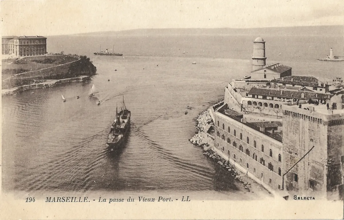
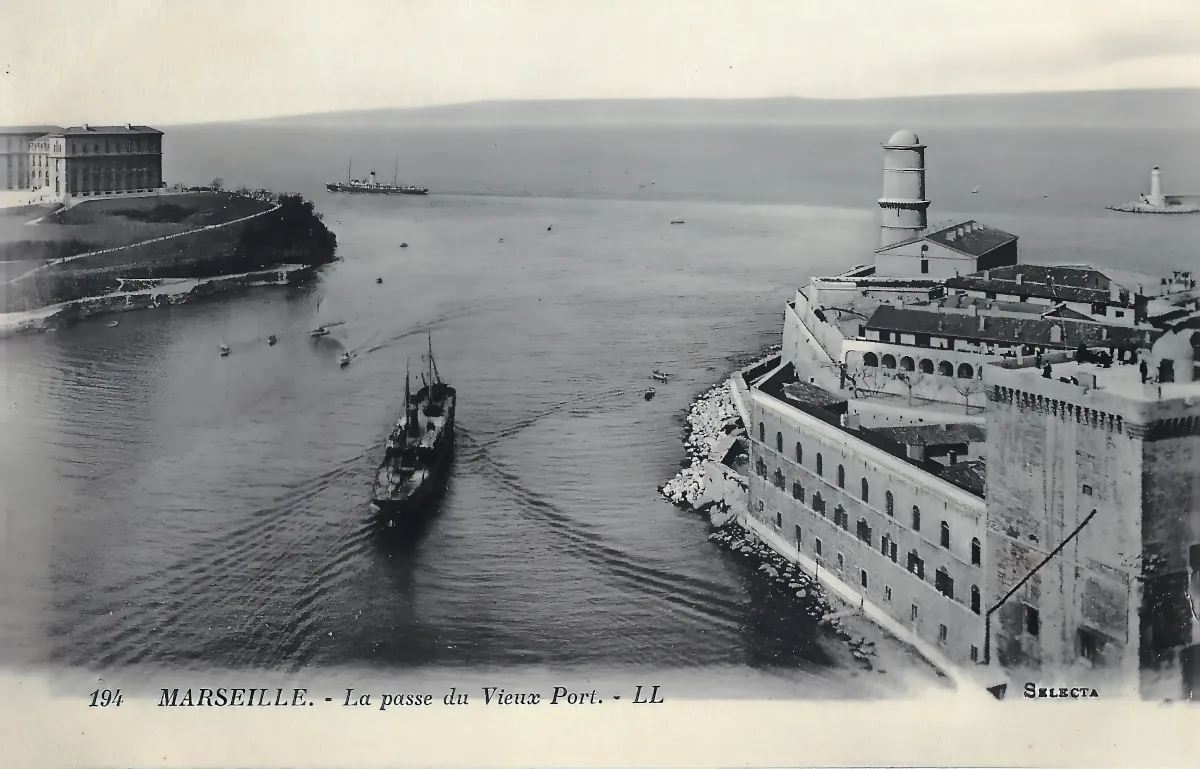
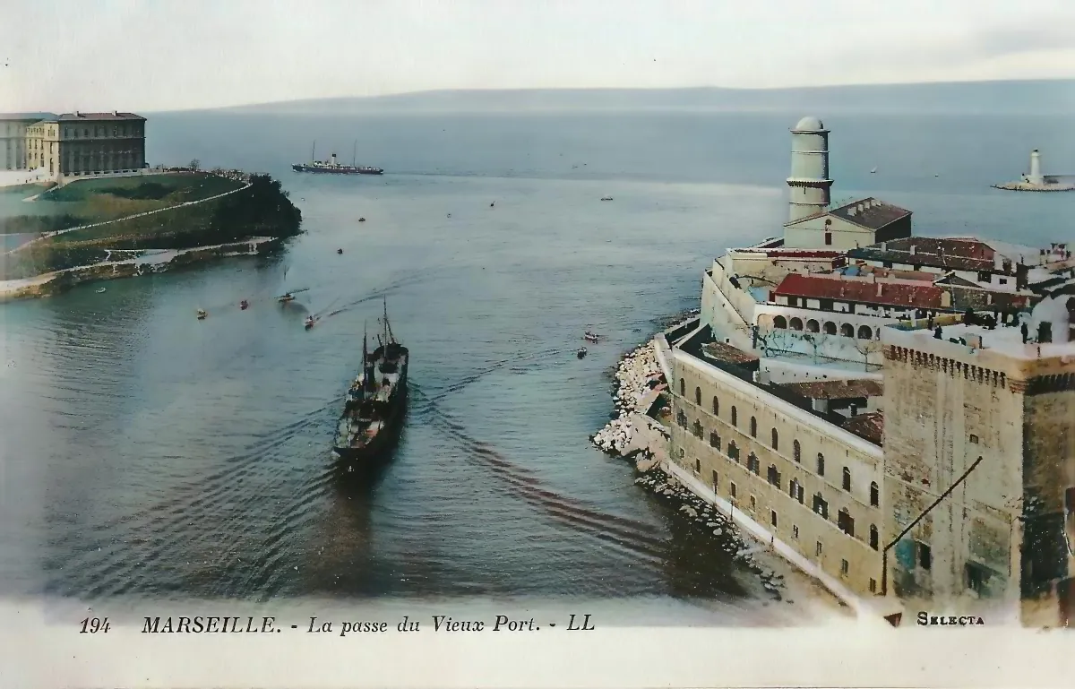
The Marseille Old Port entrance is seen here from an unusually elevated viewpoint, probably from the former transporter bridge, looking outward from the historic harbour towards the Mediterranean. The two sides of the harbour mouth frame the channel used by vessels entering and leaving the Vieux-Port.
On the right, the most prominent landmark is Fort Saint-Jean, occupying the northern side of the harbour entrance. Its massive stone walls descend almost to the waterline, clearly revealing the defensive purpose of this strategic position. Rising above the fort is the distinctive cylindrical Tour du Fanal, or Fanal Tower. Built in the seventeenth century, it served both as a lookout and as a maritime beacon, with a light at its summit helping sailors identify the entrance to the harbour.
The postcard also provides a valuable view of the internal arrangement of Fort Saint-Jean before the major changes of the modern era. Low buildings, terraces and courtyards can be seen behind the ramparts. Today the fort forms part of the Mucem complex, yet its original strategic position remains immediately understandable: it stands directly beside the narrow passage connecting the historic harbour with the open roadstead.
On the opposite side, to the left, stands the Palais du Pharo, a large rectangular building prominently positioned on the headland overlooking the sea. The palace was commissioned by Napoleon III for Empress Eugénie, and its foundation stone was laid in 1858. Its commanding position on the Pharo plateau provides extensive views over both the Old Port and the Bay of Marseille.
The southern side of the harbour entrance also includes Fort Saint-Nicolas, situated close to the Pharo. Together with Fort Saint-Jean, it forms part of the great seventeenth-century defensive system guarding the entrance to the Vieux-Port. Fort Saint-Nicolas was constructed on the orders of Louis XIV between 1660 and 1664.
A motor-powered vessel occupies the centre of the channel, heading towards the open sea and leaving a broad wake behind it. Several smaller sailing or rowing craft can also be distinguished, while a larger ship is visible farther out in the bay. The scene therefore captures a period when traditional small craft and steam-powered vessels still shared Marseille’s waters.
At the far right of the horizon, a structure resembling a lighthouse or harbour light is also visible. Its presence can be observed with confidence, but the resolution of the postcard is insufficient to identify it precisely without introducing unnecessary speculation.
The image makes the geography of the Old Port particularly clear. The narrow entrance forms the connection between the deeply sheltered historic harbour and the Mediterranean, while the fortifications on either side emphasize the strategic importance that this passage held for centuries.
Historical description
The printed caption reads “194 MARSEILLE. – La passe du Vieux Port. – LL”. The initials LL correspond to the French photographic publisher Léon et Lévy. Records held by the French National Archaeology Museum archives state that the “L.L.” trademark was registered in 1901, when the company was expanding its production of illustrated postcards.
The exact date of this particular postcard cannot be established from the front alone. Several clues, however, suggest that the photograph belongs to the early decades of the twentieth century, most probably between the mid-1900s and the early 1920s.
The most important clue is the unusually high position of the camera directly above the harbour entrance. The photograph was very probably taken from Marseille’s famous transporter bridge, a major steel structure commissioned in 1903 and inaugurated in 1905 between Fort Saint-Nicolas and Fort Saint-Jean. The bridge carried a suspended ferry platform across the harbour entrance and also provided striking elevated views of the Old Port and the Mediterranean.
This interpretation of the viewpoint remains probable rather than certain, since no part of the bridge itself appears in the photograph. Nevertheless, the height and central position of the camera correspond closely to the type of view that could be obtained from its upper structure. If this identification is correct, the photograph must date from 1905 or later.
The LL publisher’s mark also supports an early twentieth-century date. Léon et Lévy became a major producer of illustrated postcards after 1901 and was among the most important French postcard publishers of the period. The initials alone cannot provide a precise year, however, since photographic negatives and postcard series were sometimes kept in circulation for many years. A broad dating of approximately 1905 to the early 1920s is therefore more appropriate than assigning a specific year.
At that time, Marseille’s Old Port still retained a strong working maritime character. Numerous small vessels, harbour craft and steam-powered ships moved through the entrance. Although Marseille’s larger commercial harbour facilities had expanded considerably farther north during the nineteenth century, the Vieux-Port remained an active and highly symbolic maritime space at the heart of the city.
The fortifications surrounding the entrance belong to a much earlier phase of Marseille’s history. From the seventeenth century onward, Fort Saint-Jean on the north side and Fort Saint-Nicolas on the south side guarded the entrance. They reflect Louis XIV’s determination to maintain military control over this strategically important gateway to Marseille.
The transporter bridge, if it was indeed the photographer’s vantage point, is now the major missing feature of this historic landscape. Inaugurated in 1905, it became one of the best-known silhouettes of early twentieth-century Marseille. One of its towers was badly damaged in 1944, and the structure was subsequently demolished after the Second World War.
This postcard therefore brings together several layers of Marseille’s history. The forts recall the age of Louis XIV, the Palais du Pharo represents the ambitions of the Second Empire, and the probable viewpoint from the transporter bridge evokes the technological modernity of the great Mediterranean port at the beginning of the twentieth century.