Murols – Panoramic View of the Village from the Castle and Bessolles Plateau
Geographic description
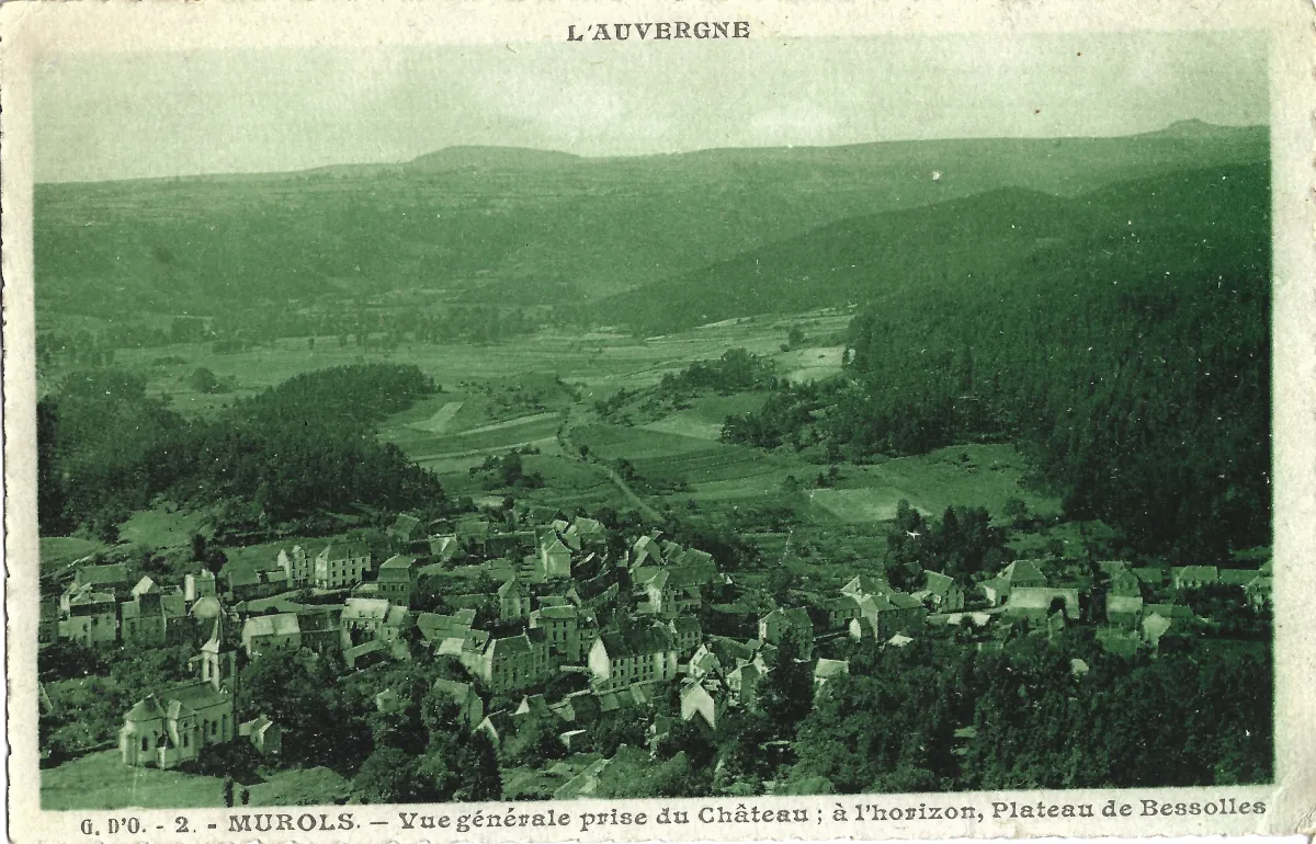
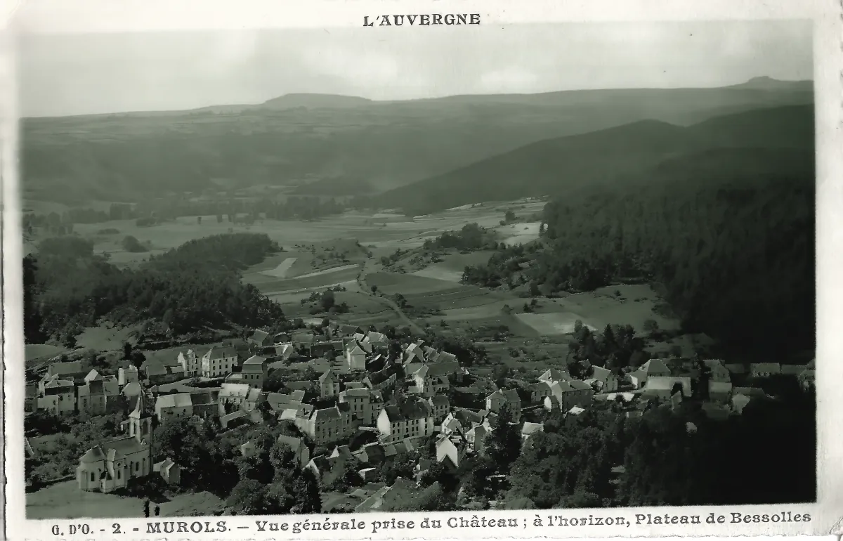
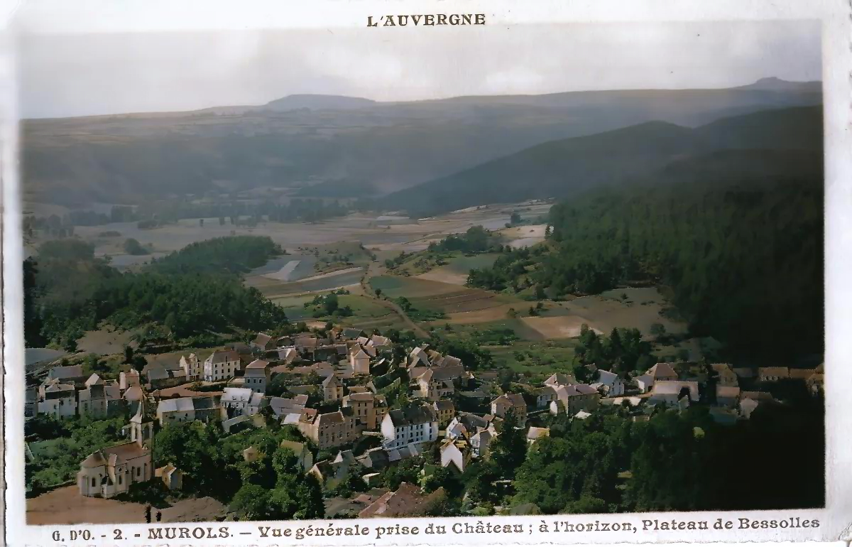
This historic view of Murol, photographed from its medieval castle, offers an impressive panorama of a village in the Puy-de-Dôme department of central France, in the Auvergne region. The postcard, bearing the former name “Murols,” shows a settlement nestled within a green valley, surrounded by wooded hills and volcanic landscapes. The Bessolles Plateau, specifically identified in the printed caption, stretches across the distant horizon.
The elevated viewpoint from Murol Castle reveals the layout of the village and its close relationship with the surrounding countryside. In the foreground, houses are clustered along narrow streets, creating a compact settlement characterized by sloping roofs and buildings of varying shapes and sizes. Their irregular arrangement reflects the gradual development of a traditional rural community.
On the left side of the photograph stands Saint-Ferréol Church, recognizable by its bell tower and distinctive religious architecture. Its prominent position makes it one of the most identifiable landmarks in the scene. Beyond the church, numerous houses extend toward the center of the village, where several larger buildings with multiple floors and regularly spaced windows can be observed.
Further into the landscape, the densely grouped buildings give way to open fields, meadows and wooded areas. Rural paths cross the valley, connecting agricultural plots and scattered properties. This gradual transition from the built environment to the surrounding countryside illustrates the importance of agriculture and natural resources in the historical organization of the settlement.
The Bessolles Plateau forms a major geographical feature of the panorama. Located among the volcanic hills surrounding Murol, it contributes to the distinctive scenery of the Monts Dore. The nearby Puy de Bessolles reaches approximately 1,057 meters above sea level.
Murol lies in the Couze Chambon valley, on the eastern side of the Sancy Massif, close to Lake Chambon and the village of Saint-Nectaire. Its geographical position explains the remarkable diversity of the surrounding terrain, where valleys, volcanic formations, elevated plateaus and forests combine to create the characteristic landscapes of this part of Auvergne.
The photograph captures a period when the village remained closely integrated into its rural surroundings. Agricultural land occupies a substantial portion of the view, while the main settlement is concentrated on the valley floor.
Taken together, these elements provide a valuable geographical record of old Murol, showing the relationship between its traditional architecture, agricultural landscape and distinctive volcanic environment.
Historical description
This vintage postcard of Murols preserves an important visual record of the village, probably dating from the early decades of the twentieth century. Although no precise publication or photographic date can be established from the image alone, its photographic presentation, architectural features and overall appearance are consistent with that period.
One of the most significant historical details is the spelling of the village’s name. The printed caption identifies the settlement as “Murols,” the former official name of present-day Murol.
This spelling was used officially during the nineteenth and early twentieth centuries. On December 24, 1953, a French government decree authorized the municipality to return to the name “Murol,” with the change taking effect on December 31. One reason for this decision was to prevent confusion with another municipality named Murols in the Aveyron department.
The old spelling therefore provides a useful historical clue. However, it does not conclusively establish the date of the photograph, since postcards could be reprinted using earlier images.
The castle from which the photograph was taken is closely connected with the village’s medieval past. Built on a commanding volcanic outcrop, Murol Castle developed over several centuries, undergoing substantial alterations during the Middle Ages and the Renaissance.
Its elevated position enabled the surrounding territory and communication routes to be observed and controlled. Long after losing its original defensive and residential functions, the fortress became one of Auvergne’s most recognizable historic landmarks. Its panoramic setting also made it an attractive location for photographers documenting the village and the landscapes of the Sancy region.
Another important architectural feature is Saint-Ferréol Church, visible on the left side of the postcard. The present building was constructed during the 1880s under the direction of architect Agis-Léon Ledru, replacing an earlier church that had fallen into disrepair.
Designed in the Gothic Revival style, the church became an important element of the village skyline. Its interior contains a notable collection of paintings created between 1890 and 1930 by Abbé Léon Boudal, the parish priest and an accomplished painter.
Boudal played a central role in the artistic history of Murols. Together with painters Victor Charreton and Wladimir de Terlikowski, he helped establish the École de Murols, an informal association of landscape artists particularly active between 1912 and 1930.
These painters were attracted by the natural beauty of the Sancy Massif, the changing light, the traditional village architecture and especially the region’s winter scenery. Their work contributed to the growing artistic reputation of Murol during the first half of the twentieth century.
The postcard also documents the village’s agricultural character. Meadows, cultivated fields and rural tracks occupy much of the surrounding valley, while buildings remain concentrated within the historic settlement.
The words “L’Auvergne” printed at the top indicate that the postcard belonged to a regional collection. The number “2” appearing beneath the photograph suggests that it formed part of a numbered series. However, the abbreviated initials in the caption are insufficient to establish the photographer’s or publisher’s identity with confidence.
The image has a distinctive green tint, resulting from the printing process rather than from natural-color photography. This treatment gives the postcard a particular visual character typical of some historical photographic reproductions.
Today, Murol is well known for its medieval castle, its proximity to Lake Chambon and its natural surroundings. This postcard remains a valuable record of the village before many of the changes associated with tourism and the expansion of modern residential areas during the twentieth century.
Beyond its picturesque appearance, the photograph illustrates the historical relationship between the village, its medieval heritage and the volcanic landscape of central Auvergne.